|
search place name
|
||
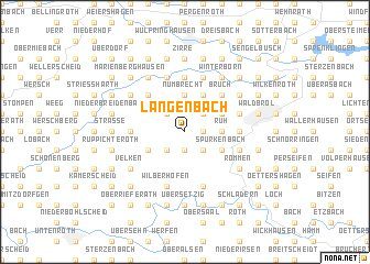
Langenbach (Nordrhein-Westfalen, Germany)Langenbach is a town in the Nordrhein-Westfalen region of Germany. An overview map of the region around Langenbach is displayed below.
regional and 3d topo map of Langenbach, Germany ::
Langenbach airports ::
The nearest airport is CGN - Cologne Koln Bonn, located 28.7 km west of Langenbach.
Other airports nearby include ZNV - Koblenz Winningen (60.2 km south), DUS - Duesseldorf Dusseldorf (72.3 km north west), DTM - Dortmund (72.6 km north), ZCA - Arnsberg Menden (72.8 km north), Nearby towns ::
Rossenbach (1.2km east) //
Ziegenhardt (1.9km south) //
Bladersbach (1.9km south) //
Hömel (2.2km north east) //
Geringhausen (2.2km north west) //
Wirtenbach (2.2km north east) //
Harscheid (2.2km north west) //
Altennümbrecht (2.2km north west) //
Ober Geilenkausen (2.2km south west) //
Niedergeilenkausen (2.2km south west) //
Geilenkausen (2.2km south west) //
Niederhausen (2.2km south east) //
Berkenroth (2.2km south west) //
Nümbrecht (3.7km north) //
Ödinghausen (3.7km north) //
Ruh (2.3km east) //
Bohlenhagen (2.3km east) //
Hoff (2.3km east) //
Puhl (3.0km north east) //
Hahn (3.0km north east) //
Distelkamp (3.9km north) //
Spurkenbach (3.0km south east) //
Benroth (3.0km south west) //
Grötzenberg (4.4km north east) //
Malzhagen (4.4km north east) //
Oberelben (4.4km north west) //
Bruch (4.4km north east) //
Drinsahl (4.4km north east) //
Göpringhausen (4.4km north west) //
[all distances 'as the bird flies' and approximate] 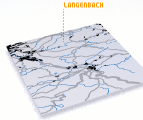 Places with similar names to Langenbach, Germany ::
// Längenbach (AT)
// Langenaubach (DE)
// Langenbach (DE)
// Langenbach (DE)
// Langenbach (DE)
// Langenbach (DE)
// Langenbach (DE)
// Langenbach (DE)
// Langenbach (DE)
// Langenbach (DE)
Disclaimer :: Information on this page comes without warranty of any kind |
||
|
Where is Langenbach? Elevation and coordinates ::
Latitude (lat): 50°52'0"N Longitude (lon): 7°33'0"E
Elevation (approx.): 266m (map arrows pan, magnifying glasses zoom) |
||
|
Visiting Langenbach? Hotel/Accommodation ::
Book a hotel in Langenbach Travel Guide ::
Buy a travel guide for Germany rental cars ::
car rental offers GPS waypoint ::
download a GPX waypoint (PoI) of Langenbach for your GPS receiver
|
||