|
search place name
|
||
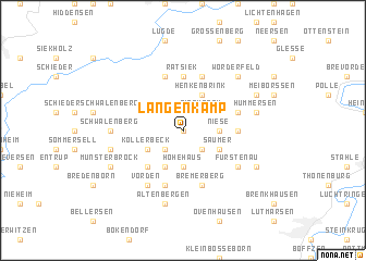
Langenkamp (Nordrhein-Westfalen, Germany)Langenkamp is a town in the Nordrhein-Westfalen region of Germany. An overview map of the region around Langenkamp is displayed below.
regional and 3d topo map of Langenkamp, Germany ::
Langenkamp airports ::
The nearest airport is KSF - Kassel Calden, located 51.6 km south of Langenkamp.
Other airports nearby include PAD - Paderborn Lippstadt (53.0 km south west), GUT - Guetersloh Gutersloh (66.4 km west), HAJ - Hannover (72.1 km north east), ZCN - Celle (95.7 km north east), Nearby towns ::
Biesterfeld (0.0km north) //
Rischenau (2.2km north east) //
Löwendorf (2.2km south east) //
Papenhöfen (2.2km south west) //
Niese (2.3km east) //
Hohehaus (3.7km south) //
Henkenbrink (3.9km north) //
Saumer (2.9km south east) //
Kollerbeck (2.9km south west) //
Großenbreden (3.9km south) //
Kleinenbreden (4.4km south west) //
Ratsiek (5.6km north) //
Köterberg (3.4km east) //
Sabbenhausen (5.7km north) //
Falkenhagen (3.9km north east) //
Bremerberg (5.7km south) //
Elbrinxen (5.7km north) //
Eilversen (5.7km south) //
Fürstenau (5.1km south east) //
Vörden (6.0km south) //
Schwalenberg (4.6km west) //
Hummersen (4.9km east) //
Born (4.9km west) //
Altenbergen (7.5km south) //
Wörderfeld (6.5km north east) //
Hünkergrund (5.9km north east) //
Bödexen (5.9km south east) //
Münsterbrock (5.9km south west) //
[all distances 'as the bird flies' and approximate]  Places with similar names to Langenkamp, Germany :: Disclaimer :: Information on this page comes without warranty of any kind |
||
|
Where is Langenkamp? Elevation and coordinates ::
Latitude (lat): 51°52'0"N Longitude (lon): 9°16'0"E
Elevation (approx.): 260m (map arrows pan, magnifying glasses zoom) |
||
|
Visiting Langenkamp? Hotel/Accommodation ::
Book a hotel in Langenkamp Travel Guide ::
Buy a travel guide for Germany rental cars ::
car rental offers GPS waypoint ::
download a GPX waypoint (PoI) of Langenkamp for your GPS receiver
|
||