|
search place name
|
||
Langhard (Baden-Württemberg, Germany)Langhard is a town in the Baden-Württemberg region of Germany. An overview map of the region around Langhard is displayed below.
regional and 3d topo map of Langhard, Germany ::

Langhard airports ::
The nearest airport is SXB - Strassbourg Entzheim, located 42.7 km west of Langhard.
Other airports nearby include ZCC - Baden-baden Baden Oos (43.5 km north), ZQL - Donaueschingen Villingen (54.3 km south east), CMR - Colmar Houssen (68.1 km south west), STR - Stuttgart (84.3 km north east), Nearby towns ::
Zuwald (1.2km east) //
Holdersbach (1.9km south) //
Schapbach (2.2km south east) //
Vor Riersbach (2.2km south west) //
Langhärdle (2.2km north west) //
Löcherberg (3.7km north) //
Langenberg (3.9km south) //
Waldhäuser (3.9km south) //
Oberharmersbach (3.1km south west) //
Kurzenbach (4.4km south east) //
Unterfreiersbach (4.4km north east) //
Bad Peterstal (4.4km north east) //
Ibach (5.6km north) //
Hohbruck (5.6km north) //
Halleckle (5.6km north) //
Hinterfreiersbach (4.1km north east) //
Gieringerloch (4.1km north east) //
Schottenhöfen (4.1km south west) //
Bärhag (4.1km north west) //
Rankach (5.2km south east) //
Gelbach (6.1km south east) //
Erzenbach (6.1km south east) //
Billersberg (5.2km south west) //
Bad Peterstal-Griesbach (5.2km north east) //
Schönwald (5.2km north west) //
Hinteribach (7.5km north) //
Guckinsdorf (7.5km north) //
Hintertal (5.3km west) //
Merkenbach (5.3km west) //
[all distances 'as the bird flies' and approximate] 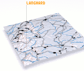 Places with similar names to Langhard, Germany ::
// Lanford (US)
// Lauenförde (DE)
// Llano Verde (PA)
// Lanfredi (IT)
// Lanford (US)
// Llano Verde (SV)
// Llano Verde (SV)
// Llano Verde (GT)
// Llano Verde (GT)
// Llano Verde (MX)
Disclaimer :: Information on this page comes without warranty of any kind |
||
|
Where is Langhard? Elevation and coordinates ::
Latitude (lat): 48°24'0"N Longitude (lon): 8°10'0"E
Elevation (approx.): 568m (map arrows pan, magnifying glasses zoom) |
||
|
Visiting Langhard? Hotel/Accommodation ::
Book a hotel in Langhard Travel Guide ::
Buy a travel guide for Germany rental cars ::
car rental offers GPS waypoint ::
download a GPX waypoint (PoI) of Langhard for your GPS receiver
|
||