|
search place name
|
||
Lichtenberg (Berlin, Germany)Lichtenberg is a town in the Berlin region of Germany. An overview map of the region around Lichtenberg is displayed below.
regional and 3d topo map of Lichtenberg, Germany ::

Lichtenberg airports ::
The nearest airport is THF - Berlin Tempelhof, located 8.1 km south west of Lichtenberg.
Other airports nearby include TXL - Berlin Tegel (15.2 km west), SXF - Berlin Schonefeld (15.3 km south), LEJ - Leipzig Halle (148.4 km south west), SZZ - Szczechin Goleniow (151.6 km north east), Nearby towns ::
Friedrichsfelde (1.1km east) //
Weiße Taube (2.2km north east) //
Rummelsburg (2.2km south east) //
Neuhohenschönhausen (3.7km north) //
Hohenschönhausen (3.7km north) //
Friedrichsberg (2.3km west) //
Wilhelmsberg (2.9km north west) //
Stralau (3.9km south) //
Weißensee (4.3km north west) //
Karlshorst (4.3km south east) //
Biesdorf (3.4km east) //
Wartenberg (5.7km north) //
Baumschulenweg (5.7km south) //
Marienthal (5.7km south) //
Falkenberg (6.0km north) //
Marzahn (5.0km north east) //
Oberschöneweide (6.0km south) //
Treptow (5.0km south west) //
Biesdorf Süd (5.0km south east) //
Niederschöneweide (7.4km south) //
Wuhlgarten (4.5km east) //
Malchow (7.5km north) //
Friedrichshain (4.9km west) //
Adlershof (7.7km south) //
Spindlersfeld (7.7km south) //
Oberspree (7.7km south) //
Heinersdorf (7.2km north west) //
Wuhlheide (7.2km south east) //
Neukölln (7.2km south west) //
[all distances 'as the bird flies' and approximate] 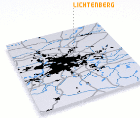 Places with similar names to Lichtenberg, Germany ::
// Lichtenberg (AT)
// Lichtenberg (AT)
// Leuchtenberg (DE)
// Leuchtenburg (DE)
// Leuchtenburg (DE)
// Leuchtenburg (DE)
// Lichtenberg (DE)
// Lichtenberg (DE)
// Lichtenberg (DE)
// Lichtenberg (DE)
Disclaimer :: Information on this page comes without warranty of any kind |
||
|
Where is Lichtenberg? Elevation and coordinates ::
Latitude (lat): 52°31'0"N Longitude (lon): 13°30'0"E
Elevation (approx.): 53m (map arrows pan, magnifying glasses zoom) |
||
|
Visiting Lichtenberg? Hotel/Accommodation ::
Book a hotel in Lichtenberg Travel Guide ::
Buy a travel guide for Germany rental cars ::
car rental offers GPS waypoint ::
download a GPX waypoint (PoI) of Lichtenberg for your GPS receiver
|
||