|
search place name
|
||
Luisenthal (Brandenburg, Germany)Luisenthal is a town in the Brandenburg region of Germany. An overview map of the region around Luisenthal is displayed below.
regional and 3d topo map of Luisenthal, Germany ::

Luisenthal airports ::
The nearest airport is SZZ - Szczechin Goleniow, located 80.4 km north east of Luisenthal.
Other airports nearby include TXL - Berlin Tegel (86.3 km south west), THF - Berlin Tempelhof (92.6 km south), SXF - Berlin Schonefeld (100.6 km south), RLG - Laage (125.0 km north west), Nearby towns ::
Charlottenhöhe (1.1km west) //
Sternhagen (2.2km south west) //
Zollchow (2.2km east) //
Schmachtenhagen (2.2km west) //
Röpersdorf (2.9km north east) //
Strehlow (3.9km south) //
Neustädter Vorstadt (5.7km north) //
Kuhdamm (5.7km north) //
Mühlhof (5.7km north) //
Pinnow (5.7km south) //
Potzlow (6.0km south) //
Lindenhagen (5.0km south west) //
Klinkow (7.4km north) //
Groß Sperrenwalde (4.4km west) //
Basedow (7.5km north) //
Ferdinandshof (4.8km south west) //
Prenzlau (6.5km north east) //
Güstow (7.7km north) //
Seehausen (7.1km south east) //
Horst (7.1km north west) //
Warnitz (8.6km south east) //
Buchholz (8.6km south west) //
[all distances 'as the bird flies' and approximate] 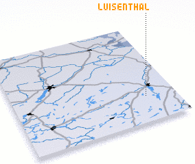 Places with similar names to Luisenthal, Germany ::
// Luisenthal (DE)
// Luisenthal (DE)
Disclaimer :: Information on this page comes without warranty of any kind |
||
|
Where is Luisenthal? Elevation and coordinates ::
Latitude (lat): 53°16'0"N Longitude (lon): 13°49'0"E
Elevation (approx.): 41m (map arrows pan, magnifying glasses zoom) |
||
|
Visiting Luisenthal? Hotel/Accommodation ::
Book a hotel in Luisenthal Travel Guide ::
Buy a travel guide for Germany rental cars ::
car rental offers GPS waypoint ::
download a GPX waypoint (PoI) of Luisenthal for your GPS receiver
|
||