|
search place name
|
||
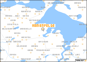
Marienfelde (Mecklenburg-Vorpommern, Germany)Marienfelde is a town in the Mecklenburg-Vorpommern region of Germany. An overview map of the region around Marienfelde is displayed below.
regional and 3d topo map of Marienfelde, Germany ::
Marienfelde airports ::
The nearest airport is SZW - Schwerin Parchim, located 55.5 km west of Marienfelde.
Other airports nearby include RLG - Laage (61.9 km north), TXL - Berlin Tegel (103.8 km south east), THF - Berlin Tempelhof (115.9 km south east), SXF - Berlin Schonefeld (128.8 km south east), Nearby towns ::
Gneve (2.2km south east) //
Gotthun (2.2km north west) //
Röbel (2.2km south west) //
Sietow Dorf (4.3km north west) //
Spitzkuhn (5.6km south) //
Ludorf (3.8km south east) //
Solzow (6.0km south) //
Zierzow (5.0km north west) //
Bollewick (6.0km south) //
Groß Kelle (4.4km west) //
Sembzin (7.5km north) //
Wackstow (5.8km south west) //
Grabenitz (7.7km north) //
Karbow (7.7km south) //
Sietow (7.1km north west) //
Vipperow (8.6km south east) //
Poppentin (8.6km north west) //
[all distances 'as the bird flies' and approximate] 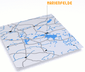 Places with similar names to Marienfelde, Germany ::
// Marienfeld (DE)
// Marienfeld (DE)
// Marienfelde (DE)
// Marienfelde (DE)
// Marienfelde (DE)
// Marienfelde (DE)
// Mariënvelde (NL)
// Marienfeld (MD)
Disclaimer :: Information on this page comes without warranty of any kind |
||
|
Where is Marienfelde? Elevation and coordinates ::
Latitude (lat): 53°24'0"N Longitude (lon): 12°37'0"E
Elevation (approx.): 73m (map arrows pan, magnifying glasses zoom) |
||
|
Visiting Marienfelde? Hotel/Accommodation ::
Book a hotel in Marienfelde Travel Guide ::
Buy a travel guide for Germany rental cars ::
car rental offers GPS waypoint ::
download a GPX waypoint (PoI) of Marienfelde for your GPS receiver
|
||