|
search place name
|
||
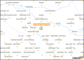
Meinersen (Niedersachsen, Germany)Meinersen is a town in the Niedersachsen region of Germany. An overview map of the region around Meinersen is displayed below.
regional and 3d topo map of Meinersen, Germany ::
Meinersen airports ::
The nearest airport is BWE - Braunschweig Wolfsburg, located 22.4 km south east of Meinersen.
Other airports nearby include ZCN - Celle (26.3 km north west), HAJ - Hannover (46.4 km west), XFW - Hamburg Finkenwerder (122.4 km north), BRE - Bremen (123.8 km north west), Nearby towns ::
Ahnsen (2.3km west) //
Dieckhorst (3.7km north) //
Gerstenbüttel (3.7km north) //
Dalldorf (3.9km south) //
Seershausen (2.9km south west) //
Bokelberge (4.3km north east) //
Müden (5.6km north) //
Volkse (5.7km south) //
Päse (3.9km north west) //
Ettenbüttel (3.9km north east) //
Ohof (5.0km south west) //
Böckelse (5.0km north west) //
Warmse (4.5km west) //
Gilde (4.9km east) //
Höfen (4.9km west) //
Eickenrode (6.5km south west) //
Flettmar (6.5km north west) //
Bahnhof Leiferde (5.8km south east) //
Hillerse (7.7km south) //
Rietze (7.7km south) //
Hahnenhorn (7.7km north) //
Leiferde (7.2km south east) //
Nienhof (8.1km north west) //
Hohnebostel (7.2km north west) //
[all distances 'as the bird flies' and approximate] 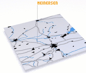 Places with similar names to Meinersen, Germany :: Disclaimer :: Information on this page comes without warranty of any kind |
||
|
Where is Meinersen? Elevation and coordinates ::
Latitude (lat): 52°29'0"N Longitude (lon): 10°22'0"E
Elevation (approx.): 48m (map arrows pan, magnifying glasses zoom) |
||
|
Visiting Meinersen? Hotel/Accommodation ::
Book a hotel in Meinersen Travel Guide ::
Buy a travel guide for Germany rental cars ::
car rental offers GPS waypoint ::
download a GPX waypoint (PoI) of Meinersen for your GPS receiver
|
||