|
search place name
|
||
Oberkail (Rheinland-Pfalz, Germany)Oberkail is a town in the Rheinland-Pfalz region of Germany. An overview map of the region around Oberkail is displayed below.
regional and 3d topo map of Oberkail, Germany ::

Oberkail airports ::
The nearest airport is SPM - Spangdahlem Ab, located 6.8 km south of Oberkail.
Other airports nearby include ZQF - Trier Fohren (20.3 km south), HHN - Frankfurt Hahn (42.7 km east), LUX - Luxemburg Luxembourg (56.6 km south west), ZNV - Koblenz Winningen (68.6 km north east), Nearby towns ::
Gransdorf (1.9km south) //
Schwarzenborn (2.4km east) //
Gindorf (3.0km south west) //
Seinsfeld (3.0km north west) //
Eisenschmitt (3.0km north east) //
Überscheid (3.0km north east) //
Eichelhütte (3.6km east) //
Spang (5.6km south) //
Spangdahlem (5.6km south) //
Dahlem (5.6km south) //
Steinborn (5.1km north west) //
Mulbach (6.0km south east) //
Orsfeld (4.8km west) //
Kyllburgweiler (5.1km west) //
Desserath (7.5km north) //
Dudeldorf (6.6km south west) //
Badem (6.0km south west) //
Binsfeld (7.8km south) //
Deudesfeld (8.2km north east) //
Niederkail (7.3km south east) //
Gondorf (8.8km south west) //
Meerfeld (8.8km north east) //
[all distances 'as the bird flies' and approximate] 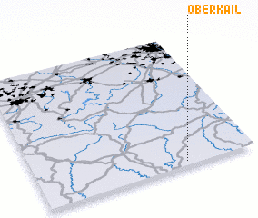 Places with similar names to Oberkail, Germany :: Disclaimer :: Information on this page comes without warranty of any kind |
||
|
Where is Oberkail? Elevation and coordinates ::
Latitude (lat): 50°2'0"N Longitude (lon): 6°41'0"E
Elevation (approx.): 357m (map arrows pan, magnifying glasses zoom) |
||
|
Visiting Oberkail? Hotel/Accommodation ::
Book a hotel in Oberkail Travel Guide ::
Buy a travel guide for Germany rental cars ::
car rental offers GPS waypoint ::
download a GPX waypoint (PoI) of Oberkail for your GPS receiver
|
||