|
search place name
|
||
Oberwildenthal (Sachsen, Germany)Oberwildenthal is a town in the Sachsen region of Germany. An overview map of the region around Oberwildenthal is displayed below.
regional and 3d topo map of Oberwildenthal, Germany ::

Oberwildenthal airports ::
The nearest airport is KLV - Karlovy Vary, located 31.8 km south east of Oberwildenthal.
Other airports nearby include HOQ - Hof Plauen (58.8 km west), AOC - Altenburg Nobitz (61.9 km north), BYU - Bayreuth (87.8 km south west), DRS - Dresden (110.7 km north east), Nearby towns ::
Wildenthal (2.2km north west) //
Sauschwemme (2.2km north east) //
Weitersglashütte (2.4km west) //
Steinbach (3.0km north east) //
Jelení (3.9km south) //
Riesenbergerhäuser (4.4km north east) //
Schimmel (4.0km north east) //
Rolava (6.0km south west) //
Erlabrunn (5.1km north east) //
Carlsfeld (4.7km west) //
Chaloupky (7.5km south) //
Přebuz (7.5km south) //
Potŭčky (5.1km east) //
Jugel (5.1km east) //
Sosa (7.5km north) //
Neues Haus (7.8km north) //
Fällbach (7.3km north east) //
Steinheidel (7.3km north east) //
Heinz Gut (8.2km north west) //
[all distances 'as the bird flies' and approximate] 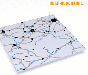 Places with similar names to Oberwildenthal, Germany :: Disclaimer :: Information on this page comes without warranty of any kind |
||
|
Where is Oberwildenthal? Elevation and coordinates ::
Latitude (lat): 50°26'0"N Longitude (lon): 12°39'0"E
Elevation (approx.): 845m (map arrows pan, magnifying glasses zoom) |
||
|
Visiting Oberwildenthal? Hotel/Accommodation ::
Book a hotel in Oberwildenthal Travel Guide ::
Buy a travel guide for Germany rental cars ::
car rental offers GPS waypoint ::
download a GPX waypoint (PoI) of Oberwildenthal for your GPS receiver
|
||