|
search place name
|
||
Obslau (Sachsen-Anhalt, Germany)Obslau is a town in the Sachsen-Anhalt region of Germany. An overview map of the region around Obslau is displayed below.
regional and 3d topo map of Obslau, Germany ::

Obslau airports ::
The nearest airport is LEJ - Leipzig Halle, located 51.1 km south of Obslau.
Other airports nearby include AOC - Altenburg Nobitz (104.6 km south), BWE - Braunschweig Wolfsburg (111.0 km north west), TXL - Berlin Tegel (117.0 km north east), THF - Berlin Tempelhof (117.4 km north east), Nearby towns ::
Steckby (2.2km north east) //
Kühren (2.3km west) //
Mennewitz (3.9km south) //
Trebbichau (5.6km south) //
Lödderitz (3.9km north west) //
Eichholz (5.7km north) //
Aken (3.9km south east) //
Kermen (6.0km north) //
Diebzig (4.6km west) //
Badetz (7.5km north) //
Kleinzerbst (6.5km south east) //
Micheln (7.8km south) //
Osternienburg (7.8km south) //
Susigke (5.9km south east) //
Tochheim (8.2km north west) //
Leps (8.2km north east) //
Breitenhagen (8.2km north west) //
Wulfen (7.2km south west) //
Reppichau (8.7km south east) //
Maxdorf (8.7km south west) //
[all distances 'as the bird flies' and approximate] 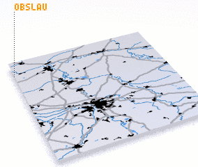 Places with similar names to Obslau, Germany ::
// Obzhyle (UA)
Disclaimer :: Information on this page comes without warranty of any kind |
||
|
Where is Obslau? Elevation and coordinates ::
Latitude (lat): 51°52'0"N Longitude (lon): 12°0'0"E
Elevation (approx.): 52m (map arrows pan, magnifying glasses zoom) |
||
|
Visiting Obslau? Hotel/Accommodation ::
Book a hotel in Obslau Travel Guide ::
Buy a travel guide for Germany rental cars ::
car rental offers GPS waypoint ::
download a GPX waypoint (PoI) of Obslau for your GPS receiver
|
||