|
search place name
|
||
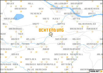
Ochtendung (Rheinland-Pfalz, Germany)Ochtendung is a town in the Rheinland-Pfalz region of Germany. An overview map of the region around Ochtendung is displayed below.
regional and 3d topo map of Ochtendung, Germany ::
Ochtendung airports ::
The nearest airport is ZNV - Koblenz Winningen, located 10.7 km east of Ochtendung.
Other airports nearby include HHN - Frankfurt Hahn (45.4 km south), CGN - Cologne Koln Bonn (59.9 km north), SPM - Spangdahlem Ab (64.8 km south west), ZQF - Trier Fohren (68.9 km south west), Nearby towns ::
Sackenheimerhöfe (2.4km east) //
Kerben (3.9km south) //
Sürzerhof (3.0km south east) //
Ruitsch (4.4km south west) //
Saffig (4.4km north east) //
Lonnig (4.4km south east) //
Kretz (5.7km north) //
Rüber (5.7km south) //
Plaidt (5.7km north) //
Kruft (5.1km north west) //
Miesenheim (6.0km north east) //
Welling (5.1km west) //
Kaan (6.6km south west) //
Dreckenach (7.8km south) //
Polch (7.3km south west) //
Lehmerhöfe (8.2km south east) //
Nickenich (8.2km north west) //
Kobern-Gondorf (7.3km south east) //
Kühr (8.8km south east) //
Weißenthurm (8.8km north east) //
Lehmen (8.8km south east) //
[all distances 'as the bird flies' and approximate]  Places with similar names to Ochtendung, Germany :: Disclaimer :: Information on this page comes without warranty of any kind |
||
|
Where is Ochtendung? Elevation and coordinates ::
Latitude (lat): 50°21'0"N Longitude (lon): 7°23'0"E
Elevation (approx.): 182m (map arrows pan, magnifying glasses zoom) |
||
|
Visiting Ochtendung? Hotel/Accommodation ::
Book a hotel in Ochtendung Travel Guide ::
Buy a travel guide for Germany rental cars ::
car rental offers GPS waypoint ::
download a GPX waypoint (PoI) of Ochtendung for your GPS receiver
|
||