|
search place name
|
||
Paindlkofen (Bayern, Germany)Paindlkofen is a town in the Bayern region of Germany. An overview map of the region around Paindlkofen is displayed below.
regional and 3d topo map of Paindlkofen, Germany ::

nearby GPS traces from timatio ::
Paindlkofen airports ::
The nearest airport is MUC - Munich Munchen, located 51.0 km south west of Paindlkofen.
Other airports nearby include FEL - Fuerstenfeldbruck Furstenfeldbruck (91.1 km south west), OBF - Oberpfaffenhofen (98.9 km south west), AGB - Augsburg (102.6 km west), SZG - Salzburg (113.1 km south east), Nearby towns ::
Unterröhrenbach (1.9km south) //
Oberröhrenbach (1.9km south) //
Hölskofen (1.2km east) //
Kienoden (1.2km west) //
Stocka (1.9km north) //
Moosthann (2.2km south east) //
Reicherstetten (2.2km south west) //
Feuchten (2.2km north east) //
Armannsberg (2.4km east) //
Mettenbach (3.7km south) //
Dürrenhettenbach (3.7km north) //
Irlsbrunn (3.9km south) //
Mausham (3.1km north east) //
Bayerbach (3.1km north east) //
Osterhaun (3.1km south west) //
Langenhettenbach (3.9km north) //
Frauenwies (3.1km north west) //
Grießenbach (4.4km south east) //
Penk (4.4km north east) //
Oberköllnbach (3.7km east) //
Martinshaun (4.1km south west) //
Unterköllnbach (4.1km south east) //
Oberellenbach (5.7km north) //
Greilsberg (6.1km north east) //
Einkreut (6.1km north west) //
Salzburg (5.2km north west) //
Gerabach (5.2km north east) //
Unterwattenbach (6.1km south west) //
Oberwattenbach (6.1km south west) //
[all distances 'as the bird flies' and approximate] 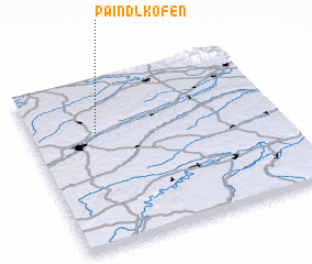 Places with similar names to Paindlkofen, Germany :: Disclaimer :: Information on this page comes without warranty of any kind |
||
|
Where is Paindlkofen? Elevation and coordinates ::
Latitude (lat): 48°41'0"N Longitude (lon): 12°16'0"E
Elevation (approx.): 438m (map arrows pan, magnifying glasses zoom) |
||
|
Visiting Paindlkofen? Hotel/Accommodation ::
Book a hotel in Paindlkofen Travel Guide ::
Buy a travel guide for Germany rental cars ::
car rental offers GPS waypoint ::
download a GPX waypoint (PoI) of Paindlkofen for your GPS receiver
|
||