|
search place name
|
||
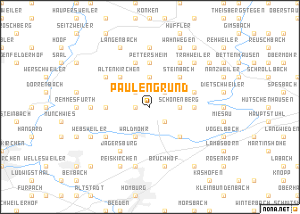
Paulengrund (Rheinland-Pfalz, Germany)Paulengrund is a town in the Rheinland-Pfalz region of Germany. An overview map of the region around Paulengrund is displayed below.
regional and 3d topo map of Paulengrund, Germany ::
Paulengrund airports ::
The nearest airport is RMS - Ramstein Ab, located 18.3 km east of Paulengrund.
Other airports nearby include SCN - Saarbruecken Saarbrucken (28.5 km south west), HHN - Frankfurt Hahn (59.5 km north), ZQF - Trier Fohren (64.2 km north west), SPM - Spangdahlem Ab (77.9 km north west), Nearby towns ::
Schmittweiler (1.2km west) //
Brücken (2.2km north east) //
Dittweiler (2.2km north west) //
Kübelberg (2.2km south east) //
Schönenberg-Kübelberg (2.2km south east) //
Schönenberg (2.4km east) //
Sand (2.4km east) //
Ohmbach (3.7km north) //
Waldmohr (3.9km south) //
Altenkirchen (4.4km north west) //
Steinbach (4.4km north east) //
Frutzweiler (4.4km north east) //
Eichelscheiderhof (4.4km south east) //
Pettersheim (5.6km north) //
Dunzweiler (3.6km west) //
Gries (3.6km east) //
Börsborn (4.1km north east) //
Krottelbach (5.7km north) //
Jägersburg (6.1km south west) //
Sangerhof (6.1km north east) //
Frohnhofen (5.2km north west) //
Neubreitenfelderhof (5.2km south west) //
Altbreitenfelderhof (5.2km south west) //
Herschweiler-Pettersheim (7.4km north) //
Herschweiler (7.4km north) //
Bambergerhof (4.8km west) //
Homburg-Nord (7.5km south) //
Sanddorf (7.5km south) //
Bruchhof (7.5km south) //
[all distances 'as the bird flies' and approximate] 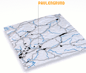 Places with similar names to Paulengrund, Germany ::
// Plan Grande (SV)
// Plan Grande (GT)
// Plan Grande (GT)
// Plan Grande (GT)
// Plan Grande (MX)
// Plan Grande (HN)
// Plan Grande (HN)
// Plan Grande (HN)
// Plan Grande (HN)
// Plan Grande (HN)
Disclaimer :: Information on this page comes without warranty of any kind |
||
|
Where is Paulengrund? Elevation and coordinates ::
Latitude (lat): 49°25'0"N Longitude (lon): 7°21'0"E
Elevation (approx.): 297m (map arrows pan, magnifying glasses zoom) |
||
|
Visiting Paulengrund? Hotel/Accommodation ::
Book a hotel in Paulengrund Travel Guide ::
Buy a travel guide for Germany rental cars ::
car rental offers GPS waypoint ::
download a GPX waypoint (PoI) of Paulengrund for your GPS receiver
|
||