|
search place name
|
||
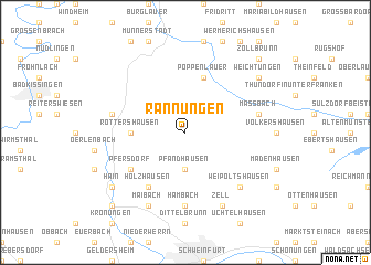
Rannungen (Bayern, Germany)Rannungen is a town in the Bayern region of Germany. An overview map of the region around Rannungen is displayed below.
regional and 3d topo map of Rannungen, Germany ::
Rannungen airports ::
The nearest airport is GHF - Giebelstadt Aaf, located 60.4 km south of Rannungen.
Other airports nearby include ZNF - Hanau Aaf (89.7 km west), NUE - Nuernberg Nurnberg (96.2 km south east), BYU - Bayreuth (103.8 km east), ERF - Erfurt (104.6 km north east), Nearby towns ::
Pfändhausen (3.7km south) //
Rottershausen (3.6km west) //
Poppenlauer (5.7km north) //
Holzhausen (6.0km south west) //
Pfersdorf (5.1km south west) //
Hambach (7.4km south) //
Maßbach (5.1km east) //
Schwarze Pfütze (5.1km west) //
Weipoltshausen (6.6km south east) //
Zell (7.8km south) //
Maibach (7.8km south) //
Weichtungen (7.3km north east) //
Hain (7.3km south west) //
Zollbrunn (8.8km north east) //
Poppenhausen (8.8km south west) //
[all distances 'as the bird flies' and approximate] 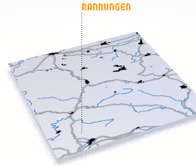 Places with similar names to Rannungen, Germany ::
Disclaimer :: Information on this page comes without warranty of any kind |
||
|
Where is Rannungen? Elevation and coordinates ::
Latitude (lat): 50°10'0"N Longitude (lon): 10°13'0"E
Elevation (approx.): 328m (map arrows pan, magnifying glasses zoom) |
||
|
Visiting Rannungen? Hotel/Accommodation ::
Book a hotel in Rannungen Travel Guide ::
Buy a travel guide for Germany rental cars ::
car rental offers GPS waypoint ::
download a GPX waypoint (PoI) of Rannungen for your GPS receiver
|
||