|
search place name
|
||
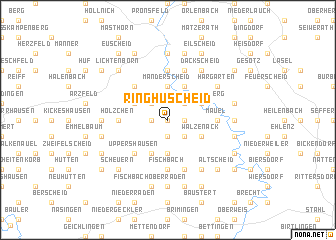
Ringhuscheid (Rheinland-Pfalz, Germany)Ringhuscheid is a town in the Rheinland-Pfalz region of Germany. An overview map of the region around Ringhuscheid is displayed below.
regional and 3d topo map of Ringhuscheid, Germany ::
Ringhuscheid airports ::
The nearest airport is SPM - Spangdahlem Ab, located 26.7 km south east of Ringhuscheid.
Other airports nearby include ZQF - Trier Fohren (38.7 km south east), LUX - Luxemburg Luxembourg (50.0 km south), HHN - Frankfurt Hahn (66.8 km east), ZNV - Koblenz Winningen (88.9 km east), Nearby towns ::
Bellscheid (0.0km north) //
Oberpierscheid (1.2km east) //
Krautscheid (1.2km west) //
Heinischseifen (1.9km south) //
Niederpierscheid (2.2km north east) //
Lauperath (2.2km north west) //
Röllersdorf (2.2km south east) //
Luppertsseifen (2.2km south east) //
Manderscheid (3.7km north) //
Burscheid (3.7km south) //
Scheidchen (3.0km north west) //
Lambertsberg (3.0km north east) //
Philippsweiler (3.0km south east) //
Walzenack (3.0km south east) //
Waxweiler (3.9km north) //
Berkoth (3.9km south) //
Kopscheid (4.4km north west) //
Uppershausen (4.4km south west) //
Fischbach (5.6km south) //
Hölzchen (3.6km west) //
Mauel (3.6km east) //
Heilhausen (5.6km north) //
Kinzenburg (5.6km north) //
Niederweidingen (5.7km south) //
Pintesfeld (5.7km north) //
Weidingen (6.0km south east) //
Hargarten (5.1km north east) //
Greimelscheid (5.1km north east) //
Dackscheid (6.0km north east) //
[all distances 'as the bird flies' and approximate] 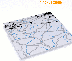 Places with similar names to Ringhuscheid, Germany :: Disclaimer :: Information on this page comes without warranty of any kind |
||
|
Where is Ringhuscheid? Elevation and coordinates ::
Latitude (lat): 50°4'0"N Longitude (lon): 6°21'0"E
Elevation (approx.): 494m (map arrows pan, magnifying glasses zoom) |
||
|
Visiting Ringhuscheid? Hotel/Accommodation ::
Book a hotel in Ringhuscheid Travel Guide ::
Buy a travel guide for Germany rental cars ::
car rental offers GPS waypoint ::
download a GPX waypoint (PoI) of Ringhuscheid for your GPS receiver
|
||