|
search place name
|
||
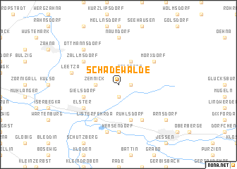
Schadewalde (Sachsen-Anhalt, Germany)Schadewalde is a town in the Sachsen-Anhalt region of Germany. An overview map of the region around Schadewalde is displayed below.
regional and 3d topo map of Schadewalde, Germany ::
Schadewalde airports ::
The nearest airport is LEJ - Leipzig Halle, located 65.6 km south west of Schadewalde.
Other airports nearby include SXF - Berlin Schonefeld (72.0 km north east), THF - Berlin Tempelhof (76.3 km north east), TXL - Berlin Tegel (81.9 km north), AOC - Altenburg Nobitz (101.9 km south), Nearby towns ::
Lüttchenseyda (1.1km east) //
Meltendorf (1.9km south) //
Seyda (2.2km north east) //
Gadegast (2.2km north east) //
Zemnick (2.3km west) //
Wolfswinkel (2.9km north west) //
Mellnitz (3.9km north) //
Gielsdorf (3.9km south west) //
Ruhlsdorf (5.7km south) //
Morxdorf (5.1km north east) //
Zallmsdorf (5.1km north west) //
Listerfehrda (6.0km south) //
Elster (5.1km south west) //
Rehain (6.0km south) //
Naundorf (7.4km north) //
Hemsendorf (7.4km south) //
Leetza (4.9km west) //
Gorsdorf (7.5km south) //
Ottmannsdorf (6.5km north west) //
Arnsdorf (7.2km south east) //
[all distances 'as the bird flies' and approximate] 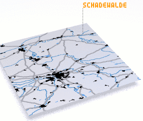 Places with similar names to Schadewalde, Germany ::
// Schattwald (AT)
Disclaimer :: Information on this page comes without warranty of any kind |
||
|
Where is Schadewalde? Elevation and coordinates ::
Latitude (lat): 51°52'0"N Longitude (lon): 12°53'0"E
Elevation (approx.): 77m (map arrows pan, magnifying glasses zoom) |
||
|
Visiting Schadewalde? Hotel/Accommodation ::
Book a hotel in Schadewalde Travel Guide ::
Buy a travel guide for Germany rental cars ::
car rental offers GPS waypoint ::
download a GPX waypoint (PoI) of Schadewalde for your GPS receiver
|
||