|
search place name
|
||
Scheiderhöhe (Nordrhein-Westfalen, Germany)Scheiderhöhe is a town in the Nordrhein-Westfalen region of Germany. An overview map of the region around Scheiderhöhe is displayed below.
regional and 3d topo map of Scheiderhöhe, Germany ::

Scheiderhöhe airports ::
The nearest airport is CGN - Cologne Koln Bonn, located 6.4 km west of Scheiderhöhe.
Other airports nearby include DUS - Duesseldorf Dusseldorf (57.3 km north west), ESS - Essen Mulheim (63.1 km north), ZNV - Koblenz Winningen (63.7 km south), MGL - Moenchengladbach Monchengladbach (65.2 km north west), Nearby towns ::
Oberscheid (1.9km north) //
Scheid (1.9km north) //
Klasberg (1.2km west) //
Wielpütz (1.2km west) //
Hausen (1.2km east) //
Mackenbach (1.2km east) //
Broich (1.9km south) //
Halberg (1.9km south) //
Muchensiefen (2.2km north west) //
Wahlscheid (2.2km north east) //
Münchhof (2.2km north east) //
Heppenberg (2.2km south west) //
Donrath (2.2km south west) //
Salgert (2.2km south east) //
Geber (2.2km south east) //
Ellhausen (2.2km south east) //
Oberhaus (3.7km north) //
Linden (3.7km north) //
Schlehecken (3.7km north) //
Heiden (3.7km north) //
Feienberg (2.3km west) //
Kellershohn (2.3km west) //
Hausdorp (2.3km east) //
Weeg (2.3km east) //
Wickühl (3.9km north) //
Stöcken (3.9km north) //
Kleinhecken (3.9km north) //
Groß Bliersbach (3.9km north) //
Großenhecken (3.9km north) //
[all distances 'as the bird flies' and approximate] 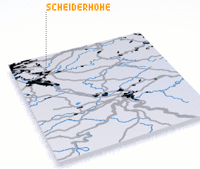 Places with similar names to Scheiderhöhe, Germany :: Disclaimer :: Information on this page comes without warranty of any kind |
||
|
Where is Scheiderhöhe? Elevation and coordinates ::
Latitude (lat): 50°52'0"N Longitude (lon): 7°14'0"E
Elevation (approx.): 122m (map arrows pan, magnifying glasses zoom) |
||
|
Visiting Scheiderhöhe? Hotel/Accommodation ::
Book a hotel in Scheiderhöhe Travel Guide ::
Buy a travel guide for Germany rental cars ::
car rental offers GPS waypoint ::
download a GPX waypoint (PoI) of Scheiderhöhe for your GPS receiver
|
||