|
search place name
|
||
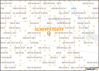
Schöpfendorf (Bayern, Germany)Schöpfendorf is a town in the Bayern region of Germany. An overview map of the region around Schöpfendorf is displayed below.
regional and 3d topo map of Schöpfendorf, Germany ::
Schöpfendorf airports ::
The nearest airport is NUE - Nuernberg Nurnberg, located 47.4 km west of Schöpfendorf.
Other airports nearby include BYU - Bayreuth (59.7 km north), HOQ - Hof Plauen (93.8 km north), KLV - Karlovy Vary (120.2 km north east), MUC - Munich Munchen (122.0 km south), Nearby towns ::
Ritzelsdorf (0.0km north) //
Pürschläg (1.2km east) //
Pfaffenhof (1.9km north) //
Gehrsricht (1.2km west) //
Stifterslohe (2.2km north east) //
Prohof (2.2km north east) //
Hermannsberg (2.2km south east) //
Götzendorf (2.2km south east) //
Seibertshof (2.2km north west) //
Hermannsdorf (2.2km north west) //
Angfeld (2.2km north west) //
Ödputzberg (2.2km north west) //
Ritzenfeld (2.2km south west) //
Haar (3.7km north) //
Dietersberg (2.4km east) //
Illschwang (2.4km west) //
Aichazandt (3.9km north) //
Ammerthal (3.0km south east) //
Oberammerthal (3.0km south east) //
Augsberg (3.9km south) //
Mörswinkl (3.0km north west) //
Reichertsfeld (3.0km south west) //
Altensee (3.0km south west) //
Kropfersricht (4.4km north east) //
Breitenbrunn (4.4km north east) //
Kotzheim (4.4km south east) //
Frankenhof (4.4km north west) //
Sternstein (5.6km north) //
Kempfenhof (5.6km north) //
[all distances 'as the bird flies' and approximate] 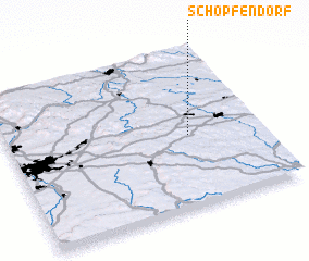 Places with similar names to Schöpfendorf, Germany :: Disclaimer :: Information on this page comes without warranty of any kind |
||
|
Where is Schöpfendorf? Elevation and coordinates ::
Latitude (lat): 49°27'0"N Longitude (lon): 11°43'0"E
Elevation (approx.): 496m (map arrows pan, magnifying glasses zoom) |
||
|
Visiting Schöpfendorf? Hotel/Accommodation ::
Book a hotel in Schöpfendorf Travel Guide ::
Buy a travel guide for Germany rental cars ::
car rental offers GPS waypoint ::
download a GPX waypoint (PoI) of Schöpfendorf for your GPS receiver
|
||