|
search place name
|
||
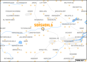
Sorgwohld (Schleswig-Holstein, Germany)Sorgwohld is a town in the Schleswig-Holstein region of Germany. An overview map of the region around Sorgwohld is displayed below.
regional and 3d topo map of Sorgwohld, Germany ::
Sorgwohld airports ::
The nearest airport is KEL - Kiel Holtenau, located 37.7 km east of Sorgwohld.
Other airports nearby include SGD - Soenderborg Sonderborg (69.9 km north), HAM - Hamburg (84.7 km south), XFW - Hamburg Finkenwerder (92.3 km south), LBC - Luebeck Lubeck Blankensee (96.8 km south east), Nearby towns ::
Krummenort (1.1km east) //
Krummenosterheide (1.9km south) //
Lohe (2.1km south west) //
Heidbunge (3.9km north) //
Lohe-Föhrden (2.8km south west) //
Owschlag (4.3km north east) //
Norby (5.7km north) //
Friedrichswiese (3.7km north west) //
Seemühlen (5.1km south east) //
Fockbek (6.0km south) //
Baken (6.0km south) //
Boklund (7.4km north) //
Tetenhusen (4.3km west) //
Föhrden (4.7km south west) //
Ramsdorf (6.4km north east) //
Steinsieken (5.7km north east) //
Julianenebene (5.7km south west) //
Kropp (8.1km north west) //
Hohn (7.0km south west) //
Altstädter Gärten (6.5km south east) //
Brekendorf (8.6km north east) //
[all distances 'as the bird flies' and approximate]  Places with similar names to Sorgwohld, Germany :: Disclaimer :: Information on this page comes without warranty of any kind |
||
|
Where is Sorgwohld? Elevation and coordinates ::
Latitude (lat): 54°21'0"N Longitude (lon): 9°34'0"E
Elevation (approx.): 22m (map arrows pan, magnifying glasses zoom) |
||
|
Visiting Sorgwohld? Hotel/Accommodation ::
Book a hotel in Sorgwohld Travel Guide ::
Buy a travel guide for Germany rental cars ::
car rental offers GPS waypoint ::
download a GPX waypoint (PoI) of Sorgwohld for your GPS receiver
|
||