|
search place name
|
||
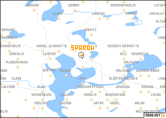
Sparow (Mecklenburg-Vorpommern, Germany)Sparow is a town in the Mecklenburg-Vorpommern region of Germany. An overview map of the region around Sparow is displayed below.
regional and 3d topo map of Sparow, Germany ::
Sparow airports ::
The nearest airport is SZW - Schwerin Parchim, located 38.9 km west of Sparow.
Other airports nearby include RLG - Laage (44.9 km north), LBC - Luebeck Lubeck Blankensee (112.5 km west), TXL - Berlin Tegel (123.7 km south east), THF - Berlin Tempelhof (136.0 km south east), Nearby towns ::
Alt Schwerin (1.1km east) //
Jürgenshof (1.9km south) //
Mönchbusch (2.2km north west) //
Werder (4.3km south west) //
Lenz (5.6km south) //
Glashütte (3.8km north west) //
Drewitz (5.7km north) //
Leisten (4.4km west) //
Adamshoffnung (7.5km south) //
Petersdorf (7.7km south) //
Quetzin (5.8km south west) //
[all distances 'as the bird flies' and approximate] 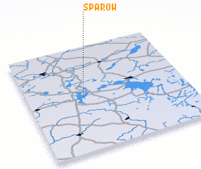 Places with similar names to Sparow, Germany ::
Disclaimer :: Information on this page comes without warranty of any kind |
||
|
Where is Sparow? Elevation and coordinates ::
Latitude (lat): 53°31'0"N Longitude (lon): 12°21'0"E
Elevation (approx.): 73m (map arrows pan, magnifying glasses zoom) |
||
|
Visiting Sparow? Hotel/Accommodation ::
Book a hotel in Sparow Travel Guide ::
Buy a travel guide for Germany rental cars ::
car rental offers GPS waypoint ::
download a GPX waypoint (PoI) of Sparow for your GPS receiver
|
||