|
search place name
|
||
Staherheide (Nordrhein-Westfalen, Germany)Staherheide is a town in the Nordrhein-Westfalen region of Germany. An overview map of the region around Staherheide is displayed below.
regional and 3d topo map of Staherheide, Germany ::

Staherheide airports ::
The nearest airport is GKE - Geilenkirchen, located 3.9 km south east of Staherheide.
Other airports nearby include MST - Maastricht (18.0 km south west), MGL - Moenchengladbach Monchengladbach (44.8 km north east), LGG - Liege (55.0 km south west), DUS - Duesseldorf Dusseldorf (63.6 km north east), Nearby towns ::
Gangelt (0.0km north) //
Nieuwe Heide (1.9km south) //
Stahe (1.2km east) //
Gangelterheide (1.2km west) //
Vintelen (1.9km north) //
Niederbusch (2.2km south east) //
Schinveld (2.2km south west) //
Bouwberg (3.7km south) //
Etzenrade (2.3km west) //
Op den Hering (2.3km east) //
Harzelt (3.7km north) //
Langbroich (3.7km north) //
Schuttersveld (3.9km south) //
Hastenrath (3.0km north west) //
Kievelberg (3.0km north west) //
Kreuzrath (3.0km north east) //
Breberen (3.9km north) //
Buscherheide (3.9km north) //
Schümm (3.9km north) //
Brüxgen (3.9km north) //
Het Heufke (4.4km south west) //
Brunssum (4.4km south west) //
Kling (4.4km south west) //
Broichhoven (4.4km north west) //
Schierwaldenrath (4.4km north east) //
Pannenschöpp (4.0km south east) //
Gillrath (4.0km south east) //
Langeberg (5.7km south) //
De Stack (5.7km south) //
[all distances 'as the bird flies' and approximate] 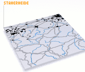 Places with similar names to Staherheide, Germany :: Disclaimer :: Information on this page comes without warranty of any kind |
||
|
Where is Staherheide? Elevation and coordinates ::
Latitude (lat): 50°59'0"N Longitude (lon): 6°0'0"E
Elevation (approx.): 52m (map arrows pan, magnifying glasses zoom) |
||
|
Visiting Staherheide? Hotel/Accommodation ::
Book a hotel in Staherheide Travel Guide ::
Buy a travel guide for Germany rental cars ::
car rental offers GPS waypoint ::
download a GPX waypoint (PoI) of Staherheide for your GPS receiver
|
||