|
search place name
|
||
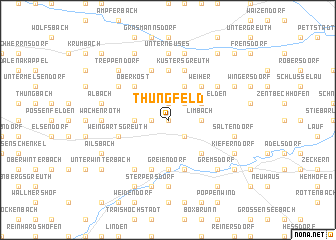
Thüngfeld (Bayern, Germany)Thüngfeld is a town in the Bayern region of Germany. An overview map of the region around Thüngfeld is displayed below.
regional and 3d topo map of Thüngfeld, Germany ::
Thüngfeld airports ::
The nearest airport is NUE - Nuernberg Nurnberg, located 34.7 km south east of Thüngfeld.
Other airports nearby include GHF - Giebelstadt Aaf (60.0 km west), BYU - Bayreuth (66.8 km north east), HOQ - Hof Plauen (97.4 km north east), ERF - Erfurt (137.4 km north), Nearby towns ::
Mühlhausen (0.0km north) //
Schirnsdorf (1.2km west) //
Stolzenroth (1.9km north) //
Nackendorf (2.2km south east) //
Steppach (2.2km north east) //
Simmersdorf (2.4km west) //
Horbach (2.4km west) //
Limbach (2.4km east) //
Unterköst (3.9km north) //
Pommersfelden (3.0km north east) //
Oberköst (4.4km north west) //
Oberndorf (4.4km north east) //
Etzelskirchen (4.4km south east) //
Weiher (4.4km north east) //
Tempelsgreuth (5.6km north) //
Greiendorf (5.6km south) //
Hirschbrunn (5.7km north) //
Lonnerstadt (5.7km south) //
Küstersgreuth (5.7km north) //
Höchstadt an der Aisch (5.7km south) //
Weingartsgreuth (4.0km south west) //
Fetzelhofen (6.1km south west) //
Sambach (5.2km north east) //
Decheldorf (5.2km north west) //
Wachenroth (4.8km west) //
Unterwinterbach (4.8km west) //
Lappach (7.4km south) //
Unterneuses (7.4km north) //
Albach (5.1km west) //
[all distances 'as the bird flies' and approximate] 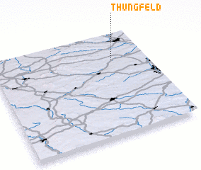 Places with similar names to Thüngfeld, Germany :: Disclaimer :: Information on this page comes without warranty of any kind |
||
|
Where is Thüngfeld? Elevation and coordinates ::
Latitude (lat): 49°45'0"N Longitude (lon): 10°47'0"E
Elevation (approx.): 271m (map arrows pan, magnifying glasses zoom) |
||
|
Visiting Thüngfeld? Hotel/Accommodation ::
Book a hotel in Thüngfeld Travel Guide ::
Buy a travel guide for Germany rental cars ::
car rental offers GPS waypoint ::
download a GPX waypoint (PoI) of Thüngfeld for your GPS receiver
|
||