|
search place name
|
||
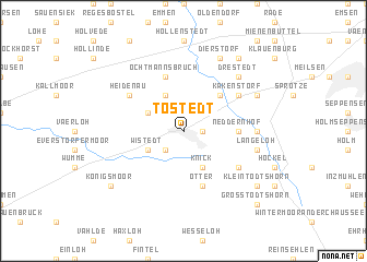
Tostedt (Niedersachsen, Germany)Tostedt is a town in the Niedersachsen region of Germany. An overview map of the region around Tostedt is displayed below.
regional and 3d topo map of Tostedt, Germany ::
Tostedt airports ::
The nearest airport is XFW - Hamburg Finkenwerder, located 29.2 km north of Tostedt.
Other airports nearby include HAM - Hamburg (42.6 km north east), BRE - Bremen (67.5 km south west), ZCN - Celle (79.7 km south), BRV - Bremerhaven (80.1 km west), Nearby towns ::
Todtglüsingen (1.1km east) //
Quellen (2.2km south west) //
Dohren (2.2km north west) //
Schillingsbostel (3.9km south) //
Knick (3.9km south) //
Wistedt (2.9km south west) //
Hollenstedterstraße (3.9km north) //
Gehege (3.9km north) //
Wüstenhöfen (2.9km north west) //
Bötersheim (4.3km north east) //
Neddernhof (3.3km east) //
Otter (5.7km south) //
Ochtmannsbruch (5.7km north) //
Kamperlien (5.0km south east) //
Heidenau (5.0km north west) //
Kakenstorf (5.0km north east) //
Lohbergen (4.4km east) //
Hoinkenbostel (4.8km south east) //
Langeloh (4.8km south east) //
Drestedt (6.5km north east) //
Trelde (5.8km north east) //
Dierstorf (7.7km north) //
Kampen (7.1km south east) //
Klein Todtshorn (7.1km south east) //
Wenzendorf (8.1km north east) //
Königsmoor (7.1km south west) //
Groß Todtshorn (8.6km south east) //
[all distances 'as the bird flies' and approximate]  Places with similar names to Tostedt, Germany ::
Disclaimer :: Information on this page comes without warranty of any kind |
||
|
Where is Tostedt? Elevation and coordinates ::
Latitude (lat): 53°17'0"N Longitude (lon): 9°43'0"E
Elevation (approx.): 62m (map arrows pan, magnifying glasses zoom) |
||
|
Visiting Tostedt? Hotel/Accommodation ::
Book a hotel in Tostedt Travel Guide ::
Buy a travel guide for Germany rental cars ::
car rental offers GPS waypoint ::
download a GPX waypoint (PoI) of Tostedt for your GPS receiver
|
||