|
search place name
|
||
Uentrop (Nordrhein-Westfalen, Germany)Uentrop is a town in the Nordrhein-Westfalen region of Germany. An overview map of the region around Uentrop is displayed below.
regional and 3d topo map of Uentrop, Germany ::

Uentrop airports ::
The nearest airport is ZCA - Arnsberg Menden, located 15.8 km north west of Uentrop.
Other airports nearby include DTM - Dortmund (35.3 km west), PAD - Paderborn Lippstadt (44.0 km north east), GUT - Guetersloh Gutersloh (60.2 km north), ESS - Essen Mulheim (79.8 km west), Nearby towns ::
Arnsberg (1.9km south) //
Breitenbruch (2.2km north east) //
Rumbeck (2.2km south east) //
Obereimer (2.3km west) //
Niedereimer (3.0km north west) //
Dinschede (3.5km east) //
Oeventrop (3.5km east) //
Bruchhausen (3.9km north west) //
Herblinghausen (6.0km south east) //
Hellefeld (7.4km south) //
Glösingen (4.6km east) //
Wennigloh (5.0km west) //
Lattenberg (5.0km west) //
Frenkhausen (6.6km south east) //
Bainghausen (7.8km south) //
Visbeck (8.2km south east) //
Neuhaus (7.2km north east) //
[all distances 'as the bird flies' and approximate] 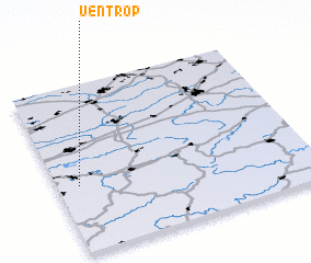
Disclaimer :: Information on this page comes without warranty of any kind |
||
|
Where is Uentrop? Elevation and coordinates ::
Latitude (lat): 51°24'0"N Longitude (lon): 8°5'0"E
Elevation (approx.): 196m (map arrows pan, magnifying glasses zoom) |
||
|
Visiting Uentrop? Hotel/Accommodation ::
Book a hotel in Uentrop Travel Guide ::
Buy a travel guide for Germany rental cars ::
car rental offers GPS waypoint ::
download a GPX waypoint (PoI) of Uentrop for your GPS receiver
|
||