|
search place name
|
||
Untermühlegg (Bayern, Germany)Untermühlegg is a town in the Bayern region of Germany. An overview map of the region around Untermühlegg is displayed below.
regional and 3d topo map of Untermühlegg, Germany ::

Untermühlegg airports ::
The nearest airport is ACH - St Gallen Altenrhein, located 52.0 km west of Untermühlegg.
Other airports nearby include FDH - Friedrichshafen (60.0 km north west), INN - Innsbruck (85.8 km east), OBF - Oberpfaffenhofen (103.3 km north east), SMV - Samedan (107.3 km south), Nearby towns ::
Obermühlegg (0.0km north) //
Muderpolz (1.9km north) //
Dietrichs (1.9km north) //
Niederdorf (1.9km south) //
Oberdorf (1.9km south) //
Weiler (1.3km east) //
Kierwang (1.3km west) //
Bolsterlang (1.3km west) //
Berg (1.3km east) //
Sigiswang (2.2km north west) //
Tiefenberg (2.2km north east) //
Maderhalm (2.2km south east) //
Fischen (2.2km south east) //
Sonderdorf (2.2km south west) //
Obermaiselstein (2.2km south west) //
Hinang (2.5km east) //
Burgegg (2.5km east) //
Bad Au (2.5km east) //
Oberthalhofen (2.5km east) //
Unterthalhofen (2.5km east) //
Wielenberg (3.7km north) //
Bettenried (3.7km north) //
Schweineberg (3.7km north) //
Ried (3.7km south) //
Altstädten (3.1km north east) //
Ofterschwang (3.9km north) //
Sigishofen (3.9km north) //
Beilenberg (4.5km north east) //
Langenwang (4.5km south east) //
[all distances 'as the bird flies' and approximate] 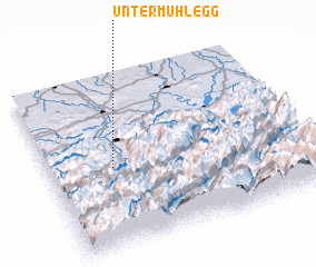 Places with similar names to Untermühlegg, Germany :: Disclaimer :: Information on this page comes without warranty of any kind |
||
|
Where is Untermühlegg? Elevation and coordinates ::
Latitude (lat): 47°28'0"N Longitude (lon): 10°15'0"E
Elevation (approx.): 811m (map arrows pan, magnifying glasses zoom) |
||
|
Visiting Untermühlegg? Hotel/Accommodation ::
Book a hotel in Untermühlegg Travel Guide ::
Buy a travel guide for Germany rental cars ::
car rental offers GPS waypoint ::
download a GPX waypoint (PoI) of Untermühlegg for your GPS receiver
|
||