|
search place name
|
||
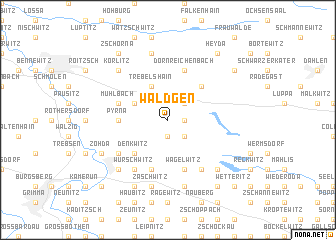
Wäldgen (Sachsen, Germany)Wäldgen is a town in the Sachsen region of Germany. An overview map of the region around Wäldgen is displayed below.
regional and 3d topo map of Wäldgen, Germany ::
Wäldgen airports ::
The nearest airport is LEJ - Leipzig Halle, located 44.3 km west of Wäldgen.
Other airports nearby include AOC - Altenburg Nobitz (44.3 km south west), DRS - Dresden (67.3 km east), BBJ - Bautzen (117.4 km east), KLV - Karlovy Vary (124.0 km south), Nearby towns ::
Sachsendorf (1.2km east) //
Fremdiswalde (1.9km south) //
Streuben (2.2km north east) //
Gaudichsroda (2.2km south east) //
Burkartshain (3.0km north west) //
Kühren (3.9km north) //
Trebelshain (3.9km north) //
Mark Schönstädt (4.4km north east) //
Denkwitz (4.4km south west) //
Pyrna (3.5km west) //
Mühlbach (3.9km north west) //
Löbschütz (5.7km south) //
Serka (5.7km south) //
Cannewitz (5.7km south) //
Wagelwitz (5.7km south) //
Dornreichenbach (5.7km north) //
Würschwitz (6.0km south west) //
Thümmlitz (6.0km south west) //
Roda (6.0km south east) //
Gornewitz (5.1km south west) //
Kühnitzsch (7.5km north) //
Zaschwitz (7.5km south) //
Gastewitz (7.5km south) //
Prösitz (7.5km south) //
Schmorditz (6.6km south west) //
Nerchau (6.6km south west) //
Mutzschen (6.6km south east) //
Körlitz (6.6km north west) //
Deditz (7.8km south) //
[all distances 'as the bird flies' and approximate]  Places with similar names to Wäldgen, Germany ::
// Willigen (CH)
Disclaimer :: Information on this page comes without warranty of any kind |
||
|
Where is Wäldgen? Elevation and coordinates ::
Latitude (lat): 51°19'0"N Longitude (lon): 12°51'0"E
Elevation (approx.): 147m (map arrows pan, magnifying glasses zoom) |
||
|
Visiting Wäldgen? Hotel/Accommodation ::
Book a hotel in Wäldgen Travel Guide ::
Buy a travel guide for Germany rental cars ::
car rental offers GPS waypoint ::
download a GPX waypoint (PoI) of Wäldgen for your GPS receiver
|
||