|
search place name
|
||
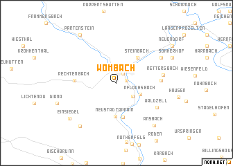
Wombach (Bayern, Germany)Wombach is a town in the Bayern region of Germany. An overview map of the region around Wombach is displayed below.
regional and 3d topo map of Wombach, Germany ::
Wombach airports ::
The nearest airport is GHF - Giebelstadt Aaf, located 46.7 km south east of Wombach.
Other airports nearby include ZNF - Hanau Aaf (48.3 km north west), FRA - Frankfurt Main (73.7 km west), MHG - Mannheim City (94.7 km south west), ZQC - Speyer (110.4 km south west), Nearby towns ::
Sendelbach (1.1km east) //
Lohr (1.7km north east) //
Rodenbach (2.8km south east) //
Pflochsbach (3.0km south east) //
Steinbach (4.7km north east) //
Sackenbach (4.7km north east) //
Neustadt am Main (5.4km south) //
Erlach (5.6km south) //
Rechtenbach (4.3km west) //
Mariabuchen (4.6km east) //
Erlenbach (4.6km east) //
Rettersbach (5.0km east) //
Waldzell (5.8km south east) //
Nantenbach (6.2km north east) //
Lindenfurterhof (7.9km south west) //
Ansbach (7.9km south east) //
Einsiedel (7.5km south west) //
Partenstein (8.7km north west) //
[all distances 'as the bird flies' and approximate] 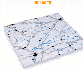 Places with similar names to Wombach, Germany ::
Disclaimer :: Information on this page comes without warranty of any kind |
||
|
Where is Wombach? Elevation and coordinates ::
Latitude (lat): 49°58'47"N Longitude (lon): 9°34'8"E
Elevation (approx.): 159m (map arrows pan, magnifying glasses zoom) |
||
|
Visiting Wombach? Hotel/Accommodation ::
Book a hotel in Wombach Travel Guide ::
Buy a travel guide for Germany rental cars ::
car rental offers GPS waypoint ::
download a GPX waypoint (PoI) of Wombach for your GPS receiver
|
||