|
search place name
|
||
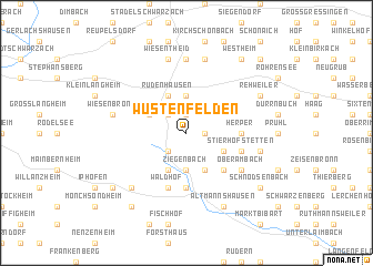
Wüstenfelden (Bayern, Germany)Wüstenfelden is a town in the Bayern region of Germany. An overview map of the region around Wüstenfelden is displayed below.
regional and 3d topo map of Wüstenfelden, Germany ::
Wüstenfelden airports ::
The nearest airport is GHF - Giebelstadt Aaf, located 30.4 km west of Wüstenfelden.
Other airports nearby include NUE - Nuernberg Nurnberg (56.9 km south east), BYU - Bayreuth (95.6 km east), ZNF - Hanau Aaf (111.9 km north west), HOQ - Hof Plauen (123.3 km north east), Nearby towns ::
Wiebelsberg (1.2km east) //
Greuth (1.9km north) //
Birklingen (2.2km south west) //
Castell (2.2km north west) //
Ziegenbach (3.7km south) //
Abtswind (3.7km north) //
Seufertshof (3.9km south) //
Mannhof (3.0km south east) //
Josephshof (3.9km south) //
Trautberg (3.0km north west) //
Rüdenhausen (3.9km north) //
Schönaich (4.4km south east) //
Enzlar (5.6km south) //
Bruckhof (5.6km south) //
Herper (3.6km east) //
Stierhöfstetten (4.0km south east) //
Krettenbach (4.0km south east) //
Seehof (5.7km south) //
Waldhof (5.7km south) //
Oberambach (5.2km south east) //
Herrnberg (5.2km south east) //
Geesdorf (7.4km north) //
Oberscheinfeld (5.1km east) //
Untersambach (7.5km north) //
Wiesentheid (7.5km north) //
Wiesenbronn (5.1km west) //
Possenheim (6.6km south west) //
Altmannshausen (7.8km south) //
Altenspeckfeld (7.8km south) //
[all distances 'as the bird flies' and approximate]  Places with similar names to Wüstenfelden, Germany :: Disclaimer :: Information on this page comes without warranty of any kind |
||
|
Where is Wüstenfelden? Elevation and coordinates ::
Latitude (lat): 49°44'0"N Longitude (lon): 10°22'0"E
Elevation (approx.): 391m (map arrows pan, magnifying glasses zoom) |
||
|
Visiting Wüstenfelden? Hotel/Accommodation ::
Book a hotel in Wüstenfelden Travel Guide ::
Buy a travel guide for Germany rental cars ::
car rental offers GPS waypoint ::
download a GPX waypoint (PoI) of Wüstenfelden for your GPS receiver
|
||