|
search place name
|
||
Antegnate (Italy)Antegnate is a town in Italy. An overview map of the region around Antegnate is displayed below.
regional and 3d topo map of Antegnate, Italy ::

Antegnate airports ::
The nearest airport is BGY - Bergamo Orio Al Serio, located 22.1 km north of Antegnate.
Other airports nearby include LIN - Milan Linate (39.8 km west), VBS - Montichiari (43.2 km east), QPZ - Piacenza (63.6 km south), PMF - Parma (83.6 km south east), Nearby towns ::
Covo (1.3km west) //
Fontanella (3.9km south) //
Romano di Lombardia (4.5km north west) //
Calcio (4.3km north east) //
Gallignano (6.8km south east) //
Camisano (6.8km south west) //
Castel Gabbiano (6.4km south west) //
Cividate al Piano (8.4km north east) //
Parre (8.4km north east) //
[all distances 'as the bird flies' and approximate] 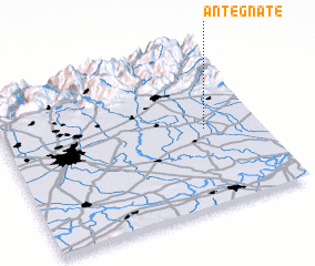
Disclaimer :: Information on this page comes without warranty of any kind |
||
|
Where is Antegnate? Elevation and coordinates ::
Latitude (lat): 45°29'0"N Longitude (lon): 9°47'0"E
Elevation (approx.): 108m (map arrows pan, magnifying glasses zoom) |
||
|
Visiting Antegnate? Hotel/Accommodation ::
Book a hotel in Antegnate Travel Guide ::
Buy a travel guide for Italy rental cars ::
car rental offers GPS waypoint ::
download a GPX waypoint (PoI) of Antegnate for your GPS receiver
|
||