|
search place name
|
||
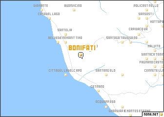
Bonifati (Italy)Bonifati is a town in Italy. An overview map of the region around Bonifati is displayed below.
regional and 3d topo map of Bonifati, Italy ::
Bonifati airports ::
The nearest airport is SUF - Lamezia Terme, located 80.9 km south of Bonifati.
Other airports nearby include CRV - Crotone (120.8 km south east), TAR - Grottaglie (165.0 km north east), REG - Reggio Calabria (169.2 km south), BRI - Bari (187.6 km north east), Nearby towns ::
Sangineto (2.3km north east) //
Cittadella del Capo (4.7km south west) //
Belvedere Marittimo (4.7km north west) //
SantʼElia (6.3km north west) //
SantʼAngelo (5.7km south east) //
Marina (5.7km north west) //
Cetraro (7.9km south) //
Borgo (7.9km south) //
[all distances 'as the bird flies' and approximate] 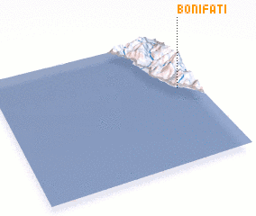 Places with similar names to Bonifati, Italy ::
// Beni Fouda (MA)
// Benefit (US)
// Benfeita (PT)
// Ban Ao Fat (TH)
// Ban A Phat (TH)
// Ban Aphut (TH)
// Ban Fit (TH)
// Ban Na Phaet (TH)
// Ban Pha Di (TH)
// Ban Pha Dui (TH)
Disclaimer :: Information on this page comes without warranty of any kind |
||
|
Where is Bonifati? Elevation and coordinates ::
Latitude (lat): 39°35'0"N Longitude (lon): 15°54'0"E
Elevation (approx.): 343m (map arrows pan, magnifying glasses zoom) |
||
|
Visiting Bonifati? Hotel/Accommodation ::
Book a hotel in Bonifati Travel Guide ::
Buy a travel guide for Italy rental cars ::
car rental offers GPS waypoint ::
download a GPX waypoint (PoI) of Bonifati for your GPS receiver
|
||