|
search place name
|
||
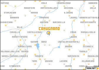
Camugnano (Italy)Camugnano is a town in Italy. An overview map of the region around Camugnano is displayed below.
regional and 3d topo map of Camugnano, Italy ::
Camugnano airports ::
The nearest airport is FLR - Firenze, located 40.8 km south of Camugnano.
Other airports nearby include BLQ - Bologna (44.1 km north), PSA - Pisa (77.2 km south west), FRL - Forli (79.0 km east), PMF - Parma (96.2 km north west), Nearby towns ::
Carpineta (2.3km north west) //
Baigno (3.7km south) //
Verzuno (3.9km north) //
Bargi (3.9km south) //
Burzanella (4.6km north east) //
Campolo (5.6km north) //
Castel di Casio (4.0km west) //
Vimignano (5.7km north) //
Piana di Giannone (4.4km north east) //
Suviana (5.4km south west) //
Castiglione dei Pepoli (6.5km south east) //
Marano (8.4km north west) //
Carpineta (8.4km south west) //
Rasora (7.7km south east) //
Il Casone (9.1km north east) //
[all distances 'as the bird flies' and approximate]  Places with similar names to Camugnano, Italy ::
// Comignano (IT)
// Kamakanein (MM)
Disclaimer :: Information on this page comes without warranty of any kind |
||
|
Where is Camugnano? Elevation and coordinates ::
Latitude (lat): 44°10'0"N Longitude (lon): 11°5'0"E
Elevation (approx.): 548m (map arrows pan, magnifying glasses zoom) |
||
|
Visiting Camugnano? Hotel/Accommodation ::
Book a hotel in Camugnano Travel Guide ::
Buy a travel guide for Italy rental cars ::
car rental offers GPS waypoint ::
download a GPX waypoint (PoI) of Camugnano for your GPS receiver
|
||