|
search place name
|
||
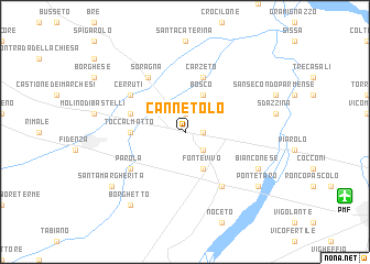
Cannetolo (Italy)Cannetolo is a town in Italy. An overview map of the region around Cannetolo is displayed below.
regional and 3d topo map of Cannetolo, Italy ::
Cannetolo airports ::
The nearest airport is PMF - Parma, located 13.3 km south east of Cannetolo.
Other airports nearby include QPZ - Piacenza (33.9 km west), VBS - Montichiari (62.3 km north), VRN - Villafranca (81.3 km north east), LIN - Milan Linate (92.8 km north west), Nearby towns ::
Fontanellato (1.3km east) //
Paroletta (1.9km north) //
Priorato (2.3km south east) //
Fontevivo (3.9km south) //
Bosco (3.9km north) //
Toccalmatto (3.9km west) //
Gazzolo (4.4km north west) //
Carzeto (5.7km north) //
Castelguelfo (6.1km south east) //
Parola (5.4km south west) //
Soragna (6.1km north west) //
Cerruti (5.4km north west) //
Bianconese (6.4km south east) //
Borghetto (8.4km south west) //
Ponte Taro (7.7km south east) //
Santa Margherita (7.7km south west) //
[all distances 'as the bird flies' and approximate] 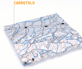 Places with similar names to Cannetolo, Italy ::
Disclaimer :: Information on this page comes without warranty of any kind |
||
|
Where is Cannetolo? Elevation and coordinates ::
Latitude (lat): 44°53'0"N Longitude (lon): 10°9'0"E
Elevation (approx.): 47m (map arrows pan, magnifying glasses zoom) |
||
|
Visiting Cannetolo? Hotel/Accommodation ::
Book a hotel in Cannetolo Travel Guide ::
Buy a travel guide for Italy rental cars ::
car rental offers GPS waypoint ::
download a GPX waypoint (PoI) of Cannetolo for your GPS receiver
|
||