|
search place name
|
||
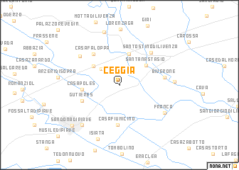
Ceggia (Veneto, Italy)Ceggia is a town in the Veneto region of Italy. An overview map of the region around Ceggia is displayed below.
regional and 3d topo map of Ceggia, Italy ::
Ceggia airports ::
The nearest airport is VCE - Venice Venezia Tessera, located 30.2 km south west of Ceggia.
Other airports nearby include TSF - Treviso (34.8 km west), AVB - Aviano Ab (Pagliano E Gori) (38.2 km north), TRS - Ronchi De Legionari Ronchi Dei Legionari (66.8 km east), QPA - Padova (69.7 km south west), Nearby towns ::
Cessalto (3.2km north west) //
Magnadola (4.2km north west) //
Fornace (5.0km north) //
SantʼAnastasio (4.2km north east) //
Casa Poles (4.2km west) //
Casa Fiumicino (6.2km south) //
Casa Faloppa (5.7km north west) //
Gutieres (4.8km south west) //
Santo Stino di Livenza (6.1km north east) //
Biverone (5.1km east) //
Chiarano (6.3km north west) //
Franca (6.6km south east) //
Torre di Mosto (6.0km east) //
Casa Gnes (7.5km south west) //
Malintrada (8.5km north) //
Lorenzaga (8.8km north) //
Isiata (8.8km south) //
San Donà di Piave (8.3km south west) //
[all distances 'as the bird flies' and approximate] 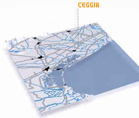 Places with similar names to Ceggia, Italy ::
Disclaimer :: Information on this page comes without warranty of any kind |
||
|
Where is Ceggia? Elevation and coordinates ::
Latitude (lat): 45°41'21"N Longitude (lon): 12°38'12"E
Elevation (approx.): 4m (map arrows pan, magnifying glasses zoom) |
||
|
Visiting Ceggia? Hotel/Accommodation ::
Book a hotel in Ceggia Travel Guide ::
Buy a travel guide for Italy rental cars ::
car rental offers GPS waypoint ::
download a GPX waypoint (PoI) of Ceggia for your GPS receiver
|
||