|
search place name
|
||
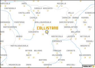
Collistano (Italy)Collistano is a town in Italy. An overview map of the region around Collistano is displayed below.
regional and 3d topo map of Collistano, Italy ::
Collistano airports ::
The nearest airport is QPZ - Piacenza, located 41.1 km north east of Collistano.
Other airports nearby include GOA - Genoa Genova Sestri (48.9 km south west), LIN - Milan Linate (81.0 km north), PMF - Parma (81.1 km east), MXP - Milano Malpensa (110.6 km north west), Nearby towns ::
Cortevezzo (1.3km west) //
Brallo (2.3km north west) //
Brallo di Pregola (3.9km north) //
Casone (3.9km north) //
Montazzolo (3.2km south east) //
Carisasca (4.5km south east) //
Cencerato (4.0km west) //
Ceregate (4.4km north west) //
Cignolo (6.8km north west) //
Sala (7.9km north) //
Belnome (7.9km south) //
San Cristoforo (6.4km north east) //
Traschio (7.9km south) //
Zanacchi (7.7km north east) //
Artana (9.1km south west) //
[all distances 'as the bird flies' and approximate] 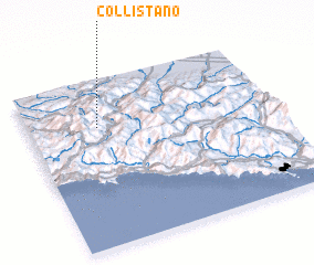 Places with similar names to Collistano, Italy ::
Disclaimer :: Information on this page comes without warranty of any kind |
||
|
Where is Collistano? Elevation and coordinates ::
Latitude (lat): 44°43'0"N Longitude (lon): 9°17'0"E
Elevation (approx.): 732m (map arrows pan, magnifying glasses zoom) |
||
|
Visiting Collistano? Hotel/Accommodation ::
Book a hotel in Collistano Travel Guide ::
Buy a travel guide for Italy rental cars ::
car rental offers GPS waypoint ::
download a GPX waypoint (PoI) of Collistano for your GPS receiver
|
||