|
search place name
|
||
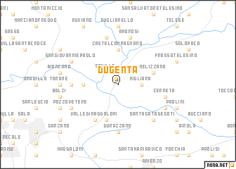
Dugenta (Italy)Dugenta is a town in Italy. An overview map of the region around Dugenta is displayed below.
regional and 3d topo map of Dugenta, Italy ::
Dugenta airports ::
The nearest airport is NAP - Naples Capodichino, located 30.6 km south west of Dugenta.
Other airports nearby include FOG - Foggia Gino Lisa (96.8 km east), QLT - Latina (136.8 km west), PSR - Pescara (145.9 km north), CIA - Rome Ciampino (171.7 km north west), Nearby towns ::
Squille (2.3km north west) //
Migliara (2.8km east) //
Ave Gratia Plena (4.2km west) //
Castel Campagnano (5.6km north) //
Bagnoli (5.7km south) //
Melizzano (4.6km north east) //
Valle di Maddaloni (6.2km south west) //
Durazzano (7.4km south) //
Castello (7.4km south) //
Limatola (5.6km west) //
Cerreta (5.9km east) //
Amorosi (7.5km north) //
Alvignanello (7.5km north) //
SantʼAgata deʼ Goti (7.0km south east) //
Pozzovetere (6.7km south west) //
Faggiano (6.7km south east) //
San Giovanni e Paolo (6.7km north west) //
[all distances 'as the bird flies' and approximate] 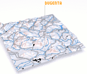 Places with similar names to Dugenta, Italy ::
Disclaimer :: Information on this page comes without warranty of any kind |
||
|
Where is Dugenta? Elevation and coordinates ::
Latitude (lat): 41°8'0"N Longitude (lon): 14°27'0"E
Elevation (approx.): 53m (map arrows pan, magnifying glasses zoom) |
||
|
Visiting Dugenta? Hotel/Accommodation ::
Book a hotel in Dugenta Travel Guide ::
Buy a travel guide for Italy rental cars ::
car rental offers GPS waypoint ::
download a GPX waypoint (PoI) of Dugenta for your GPS receiver
|
||