|
search place name
|
||
Ghisellina (Italy)Ghisellina is a town in Italy. An overview map of the region around Ghisellina is displayed below.
regional and 3d topo map of Ghisellina, Italy ::

Ghisellina airports ::
The nearest airport is BLQ - Bologna, located 35.0 km south of Ghisellina.
Other airports nearby include VRN - Villafranca (69.4 km north west), QPA - Padova (73.7 km north east), PMF - Parma (80.7 km west), VIC - Vicenza (82.1 km north), Nearby towns ::
Scortichino (3.9km north) //
Villa Magri (3.2km north west) //
Finale Emilia (3.2km south west) //
Casa Alta (4.5km north east) //
La Fruttarola (4.5km north west) //
Le Cremosine (3.9km west) //
Ponte Trevisani (5.6km east) //
Casa Furnetta (7.5km north) //
Galeazza Pepoli (6.8km south west) //
Burana (7.9km north) //
SantʼAgostino (7.7km south east) //
Redena (8.4km north west) //
[all distances 'as the bird flies' and approximate] 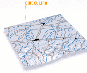 Places with similar names to Ghisellina, Italy ::
Disclaimer :: Information on this page comes without warranty of any kind |
||
|
Where is Ghisellina? Elevation and coordinates ::
Latitude (lat): 44°51'0"N Longitude (lon): 11°19'0"E
Elevation (approx.): 11m (map arrows pan, magnifying glasses zoom) |
||
|
Visiting Ghisellina? Hotel/Accommodation ::
Book a hotel in Ghisellina Travel Guide ::
Buy a travel guide for Italy rental cars ::
car rental offers GPS waypoint ::
download a GPX waypoint (PoI) of Ghisellina for your GPS receiver
|
||