|
search place name
|
||
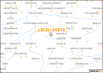
La Collevata (Italy)La Collevata is a town in Italy. An overview map of the region around La Collevata is displayed below.
regional and 3d topo map of La Collevata, Italy ::
La Collevata airports ::
The nearest airport is BLQ - Bologna, located 43.6 km south east of La Collevata.
Other airports nearby include VRN - Villafranca (58.1 km north), PMF - Parma (58.6 km west), VBS - Montichiari (82.0 km north west), QPA - Padova (85.7 km north east), Nearby towns ::
Mirandola (2.6km east) //
Alberica (3.7km north) //
San Giacomo Roncole (3.2km south east) //
Disvetro (3.2km south east) //
Medolla (4.5km south east) //
Cavezzo (5.6km south) //
La Pettenella (4.4km north east) //
La Balantina (4.4km north west) //
Pioppa (5.4km south west) //
Concordia sulla Secchia (5.4km north west) //
Rovereto (6.4km south west) //
Quarantoli (6.4km north east) //
Melara (7.7km south east) //
Tramuschio (8.4km north east) //
Corte Romana (8.4km north west) //
Casate Stoffi (8.4km north west) //
[all distances 'as the bird flies' and approximate] 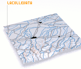 Places with similar names to La Collevata, Italy ::
// La Clavada (MX)
Disclaimer :: Information on this page comes without warranty of any kind |
||
|
Where is La Collevata? Elevation and coordinates ::
Latitude (lat): 44°53'0"N Longitude (lon): 11°2'0"E
Elevation (approx.): 13m (map arrows pan, magnifying glasses zoom) |
||
|
Visiting La Collevata? Hotel/Accommodation ::
Book a hotel in La Collevata Travel Guide ::
Buy a travel guide for Italy rental cars ::
car rental offers GPS waypoint ::
download a GPX waypoint (PoI) of La Collevata for your GPS receiver
|
||