|
search place name
|
||
La Collina (Italy)La Collina is a town in Italy. An overview map of the region around La Collina is displayed below.
regional and 3d topo map of La Collina, Italy ::

La Collina airports ::
The nearest airport is FLR - Firenze, located 37.5 km north east of La Collina.
Other airports nearby include PSA - Pisa (41.7 km west), SAY - Siena Ampugnano (45.8 km south east), GRS - Grosseto (90.9 km south), EBA - Marina Di Campo (103.8 km south west), Nearby towns ::
Sughera (2.7km west) //
Castelfalfi (3.3km south west) //
Montaione (3.3km south east) //
Collegalli (4.6km north west) //
Barbialla (5.6km north) //
Leccio (5.7km north) //
San Vivaldo (5.7km south) //
Coiano (6.2km north east) //
Querce (5.4km east) //
Campriano (7.5km north) //
La Cava (7.5km south) //
Gambassi (6.5km south east) //
Cedri (9.2km south west) //
[all distances 'as the bird flies' and approximate] 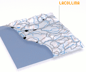 Places with similar names to La Collina, Italy ::
// Lea Glen (US)
// La Colonia (PA)
// La Gallina (PA)
// Ligliano (IT)
// Lugliano (IT)
// La Colonia (CU)
// La Gallina (CU)
// La Gallina (CU)
// L-Iklin (MT)
// La Colonia (ES)
Disclaimer :: Information on this page comes without warranty of any kind |
||
|
Where is La Collina? Elevation and coordinates ::
Latitude (lat): 43°34'0"N Longitude (lon): 10°53'0"E
Elevation (approx.): 176m (map arrows pan, magnifying glasses zoom) |
||
|
Visiting La Collina? Hotel/Accommodation ::
Book a hotel in La Collina Travel Guide ::
Buy a travel guide for Italy rental cars ::
car rental offers GPS waypoint ::
download a GPX waypoint (PoI) of La Collina for your GPS receiver
|
||