|
search place name
|
||
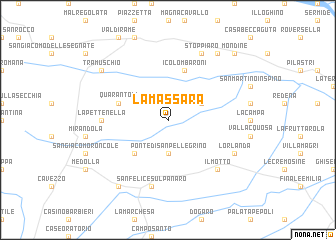
La Massara (Italy)La Massara is a town in Italy. An overview map of the region around La Massara is displayed below.
regional and 3d topo map of La Massara, Italy ::
La Massara airports ::
The nearest airport is BLQ - Bologna, located 42.0 km south of La Massara.
Other airports nearby include VRN - Villafranca (58.8 km north), PMF - Parma (68.0 km west), QPA - Padova (77.8 km north east), VIC - Vicenza (80.6 km north), Nearby towns ::
Ponte di San Pellegrino (3.7km south) //
Gavello (3.2km north east) //
San Biagio (4.5km south west) //
Quarantoli (4.4km north west) //
I Colombaroni (5.7km north) //
La Pettenella (5.3km west) //
San Felice sul Panaro (7.5km south) //
Il Motto (6.8km south east) //
LʼOrlanda (6.4km south east) //
Stoppiaro (7.9km north) //
Cantaboa (8.4km north east) //
Melara (8.4km south west) //
Tramuschio (7.6km north west) //
Mondine (9.1km north east) //
[all distances 'as the bird flies' and approximate]  Places with similar names to La Massara, Italy ::
Disclaimer :: Information on this page comes without warranty of any kind |
||
|
Where is La Massara? Elevation and coordinates ::
Latitude (lat): 44°54'0"N Longitude (lon): 11°9'0"E
Elevation (approx.): 7m (map arrows pan, magnifying glasses zoom) |
||
|
Visiting La Massara? Hotel/Accommodation ::
Book a hotel in La Massara Travel Guide ::
Buy a travel guide for Italy rental cars ::
car rental offers GPS waypoint ::
download a GPX waypoint (PoI) of La Massara for your GPS receiver
|
||