|
search place name
|
||
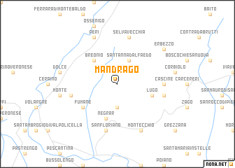
Mandrago (Italy)Mandrago is a town in Italy. An overview map of the region around Mandrago is displayed below.
regional and 3d topo map of Mandrago, Italy ::
Mandrago airports ::
The nearest airport is VRN - Villafranca, located 21.1 km south of Mandrago.
Other airports nearby include VIC - Vicenza (46.5 km east), VBS - Montichiari (50.1 km west), QPA - Padova (74.5 km east), BGY - Bergamo Orio Al Serio (96.4 km west), Nearby towns ::
Marano di Valpolicella (3.7km south) //
SantʼAnna dʼAlfaedo (3.9km north) //
Breonio (4.5km north west) //
Negrar (5.7km south) //
Lugo (4.3km south east) //
Fumane (5.4km south west) //
Cascine (5.2km east) //
San Floriano (7.5km south) //
Cavalo (5.5km west) //
Corrubio (5.5km east) //
Selvavecchia (7.5km north) //
Montecchio (7.9km south) //
Peri (7.9km north) //
Erbezzo (7.6km north east) //
[all distances 'as the bird flies' and approximate]  Places with similar names to Mandrago, Italy ::
// Montereggio (IT)
// Mëndrakë (AL)
// Mandıraköy (TR)
// Montroig (ES)
// Mandraka (MG)
// Mandraka (MG)
// Mount Riga (US)
// Mount Rock (US)
// Mount Rock (US)
// Mount Rock (US)
Disclaimer :: Information on this page comes without warranty of any kind |
||
|
Where is Mandrago? Elevation and coordinates ::
Latitude (lat): 45°35'0"N Longitude (lon): 10°56'0"E
Elevation (approx.): 652m (map arrows pan, magnifying glasses zoom) |
||
|
Visiting Mandrago? Hotel/Accommodation ::
Book a hotel in Mandrago Travel Guide ::
Buy a travel guide for Italy rental cars ::
car rental offers GPS waypoint ::
download a GPX waypoint (PoI) of Mandrago for your GPS receiver
|
||