|
search place name
|
||
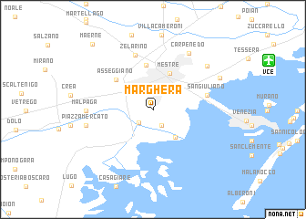
Marghera (Veneto, Italy)Marghera is a town in the Veneto region of Italy. An overview map of the region around Marghera is displayed below.
regional and 3d topo map of Marghera, Italy ::
nearby GPS traces from timatio ::
Marghera airports ::
The nearest airport is VCE - Venice Venezia Tessera, located 11.7 km north east of Marghera.
Other airports nearby include TSF - Treviso (22.0 km north), QPA - Padova (30.1 km west), VIC - Vicenza (55.9 km west), AVB - Aviano Ab (Pagliano E Gori) (70.8 km north east), Nearby towns ::
Moranzani (2.1km south) //
Malcontenta (2.0km south west) //
Fusina (3.9km south east) //
Mestre (4.6km north) //
Zelo (5.5km north) //
Asseggiano (4.8km north west) //
San Giuliano (4.9km east) //
Zelarino (6.8km north) //
Carpenedo (7.5km north east) //
Malpaga (5.8km west) //
Piazza Mercato (6.1km west) //
Favaro Veneto (7.1km north east) //
Campalto (6.9km north east) //
Maerne (9.6km north west) //
[all distances 'as the bird flies' and approximate]  Places with similar names to Marghera, Italy ::
// Murphree (US)
// Mirafiori (IT)
// Mooirivier (ZA)
// Marofaria (MG)
// Marofarihy (MG)
// Marofarihy (MG)
// Marofarihy (MG)
// Marofarihy (MG)
// Marovario (MG)
// Marovary (MG)
Disclaimer :: Information on this page comes without warranty of any kind |
||
|
Where is Marghera? Elevation and coordinates ::
Latitude (lat): 45°27'4"N Longitude (lon): 12°13'26"E
Elevation (approx.): 4m (map arrows pan, magnifying glasses zoom) |
||
|
Visiting Marghera? Hotel/Accommodation ::
Book a hotel in Marghera Travel Guide ::
Buy a travel guide for Italy rental cars ::
car rental offers GPS waypoint ::
download a GPX waypoint (PoI) of Marghera for your GPS receiver
|
||