|
search place name
|
||
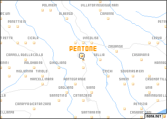
Pentone (Italy)Pentone is a town in Italy. An overview map of the region around Pentone is displayed below.
regional and 3d topo map of Pentone, Italy ::
Pentone airports ::
The nearest airport is SUF - Lamezia Terme, located 30.8 km west of Pentone.
Other airports nearby include CRV - Crotone (43.1 km east), REG - Reggio Calabria (129.8 km south west), TAR - Grottaglie (184.3 km north), LCC - Lecce (192.8 km north east), Nearby towns ::
Fossato Serralta (0.0km north) //
SantʼElia (1.9km south) //
Sellia (2.9km east) //
Taverna (3.7km north) //
Sorbo San Basile (4.0km north) //
Maranise (4.0km north) //
Vincolise (4.0km north) //
Albi (4.0km north) //
Pontegrande (5.7km south) //
Gimigliano (4.7km south west) //
Crichi (5.7km south east) //
Siano (7.6km south) //
Zagarise (6.1km east) //
Gagliano (8.0km south) //
[all distances 'as the bird flies' and approximate] 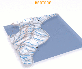 Places with similar names to Pentone, Italy ::
Disclaimer :: Information on this page comes without warranty of any kind |
||
|
Where is Pentone? Elevation and coordinates ::
Latitude (lat): 38°59'0"N Longitude (lon): 16°35'0"E
Elevation (approx.): 541m (map arrows pan, magnifying glasses zoom) |
||
|
Visiting Pentone? Hotel/Accommodation ::
Book a hotel in Pentone Travel Guide ::
Buy a travel guide for Italy rental cars ::
car rental offers GPS waypoint ::
download a GPX waypoint (PoI) of Pentone for your GPS receiver
|
||