|
search place name
|
||
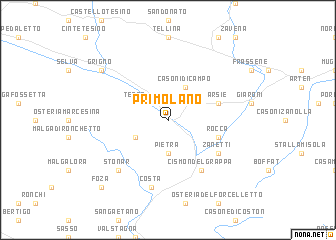
Primolano (Italy)Primolano is a town in Italy. An overview map of the region around Primolano is displayed below.
regional and 3d topo map of Primolano, Italy ::
Primolano airports ::
The nearest airport is VIC - Vicenza, located 45.7 km south of Primolano.
Other airports nearby include TSF - Treviso (52.2 km south east), BZO - Bolzano (62.0 km north west), QPA - Padova (64.5 km south), AVB - Aviano Ab (Pagliano E Gori) (69.8 km east), Nearby towns ::
Pietra (3.7km south) //
Tezze (3.2km north west) //
Casara Tombal (3.2km south west) //
Casoni di Campo (3.9km north) //
Arsiè (4.3km north east) //
Rocca (4.3km south east) //
Cismon del Grappa (6.1km south east) //
Zanetti (5.4km south east) //
Costa (7.5km south) //
Stonar (6.8km south west) //
Grigno (7.6km north west) //
Foza (9.0km south west) //
[all distances 'as the bird flies' and approximate] 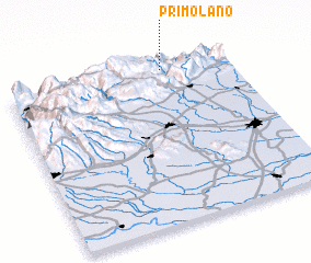 Places with similar names to Primolano, Italy ::
Disclaimer :: Information on this page comes without warranty of any kind |
||
|
Where is Primolano? Elevation and coordinates ::
Latitude (lat): 45°58'0"N Longitude (lon): 11°42'0"E
Elevation (approx.): 242m (map arrows pan, magnifying glasses zoom) |
||
|
Visiting Primolano? Hotel/Accommodation ::
Book a hotel in Primolano Travel Guide ::
Buy a travel guide for Italy rental cars ::
car rental offers GPS waypoint ::
download a GPX waypoint (PoI) of Primolano for your GPS receiver
|
||