|
search place name
|
||
Richardet (Italy)Richardet is a town in Italy. An overview map of the region around Richardet is displayed below.
regional and 3d topo map of Richardet, Italy ::

Richardet airports ::
The nearest airport is TRN - Torino, located 63.1 km east of Richardet.
Other airports nearby include CUF - Levaldigi (79.7 km south east), CMF - Chambery Aix Les Bains (103.4 km north west), NCY - Annecy Meythet (116.9 km north west), GNB - Grenoble Saint Geoirs (127.5 km west), Nearby towns ::
Sauze dʼOulx (1.3km west) //
Monfol (1.9km north) //
Gad (2.6km west) //
Salabertano (3.7km north) //
Margherie del Seu (3.2km north east) //
Moncellier (5.6km north) //
Abbazia (3.9km west) //
Abbaziz (3.9km west) //
Oulx (3.9km west) //
Eclause (5.7km north) //
Plan (6.1km south east) //
Joussaud (6.1km south east) //
Traverses (6.1km south east) //
Pattemouche (6.1km south east) //
Borgata Sestriere (7.4km south) //
Ruà (5.6km east) //
Souchères Hautes (5.6km east) //
Laval (7.9km south) //
Deveys (7.9km north) //
San Colombano (7.9km north) //
Colombiere (7.6km south west) //
Autagne (7.6km south west) //
Seytes (8.4km south east) //
Exilles (8.4km north east) //
Campriond (9.1km north east) //
[all distances 'as the bird flies' and approximate] 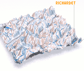 Places with similar names to Richardet, Italy :: Disclaimer :: Information on this page comes without warranty of any kind |
||
|
Where is Richardet? Elevation and coordinates ::
Latitude (lat): 45°2'0"N Longitude (lon): 6°53'0"E
Elevation (approx.): 2026m (map arrows pan, magnifying glasses zoom) |
||
|
Visiting Richardet? Hotel/Accommodation ::
Book a hotel in Richardet Travel Guide ::
Buy a travel guide for Italy rental cars ::
car rental offers GPS waypoint ::
download a GPX waypoint (PoI) of Richardet for your GPS receiver
|
||