|
search place name
|
||
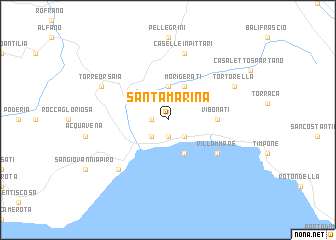
Santa Marina (Italy)Santa Marina is a town in Italy. An overview map of the region around Santa Marina is displayed below.
regional and 3d topo map of Santa Marina, Italy ::
Santa Marina airports ::
The nearest airport is NAP - Naples Capodichino, located 136.8 km north west of Santa Marina.
Other airports nearby include SUF - Lamezia Terme (146.0 km south east), FOG - Foggia Gino Lisa (148.0 km north), BRI - Bari (155.2 km north east), TAR - Grottaglie (165.6 km east), Nearby towns ::
Orcazzo (1.4km west) //
Bussentino (1.9km south) //
Policastro Bussentino (2.3km south west) //
San Cristoforo (2.3km south east) //
Sicilì (3.7km north) //
Morigerati (4.0km north) //
Capitello (4.0km south) //
Vibonati (4.3km east) //
Villammare (5.6km south east) //
Caselle in Pittari (7.5km north) //
Garigliano (7.0km south west) //
Scario (7.0km south west) //
Castel Ruggero (6.8km north west) //
Torre Orsaia (6.8km north west) //
Tortorella (6.8km north east) //
[all distances 'as the bird flies' and approximate] 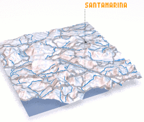 Places with similar names to Santa Marina, Italy ::
// Santa Marina (IT)
// Santa Marina (IT)
// Sandomérion (GR)
// Santa Mariana (CU)
// Santa Marina (CU)
// Santa Marina (CU)
// Santa Mariña (ES)
// Santa Marina (ES)
// Santa Marina (ES)
// Santa Marina (ES)
Disclaimer :: Information on this page comes without warranty of any kind |
||
|
Where is Santa Marina? Elevation and coordinates ::
Latitude (lat): 40°6'0"N Longitude (lon): 15°32'0"E
Elevation (approx.): 393m (map arrows pan, magnifying glasses zoom) |
||
|
Visiting Santa Marina? Hotel/Accommodation ::
Book a hotel in Santa Marina Travel Guide ::
Buy a travel guide for Italy rental cars ::
car rental offers GPS waypoint ::
download a GPX waypoint (PoI) of Santa Marina for your GPS receiver
|
||