|
search place name
|
||
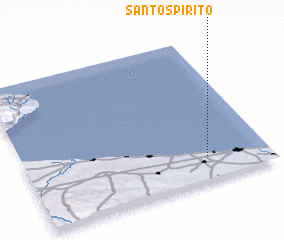
Santo Spirito (Italy)Santo Spirito is a town in Italy. An overview map of the region around Santo Spirito is displayed below.
regional and 3d topo map of Santo Spirito, Italy ::

Santo Spirito airports ::
The nearest airport is BRI - Bari, located 3.2 km south of Santo Spirito.
Other airports nearby include TAR - Grottaglie (90.7 km south east), FOG - Foggia Gino Lisa (106.0 km west), BDS - Brindisi Casale (115.6 km south east), LCC - Lecce (155.8 km south east), Nearby towns ::
 Places with similar names to Santo Spirito, Italy ::
// Santo Spirito (IT)
// Santo Espírito (PT)
// Sandspruit (ZA)
// Saint-Esprit (GF)
// Santo Espíritu (DO)
// Santo Espíritu (DO)
// Saint-Esprit (FR)
Disclaimer :: Information on this page comes without warranty of any kind |
||
|
Where is Santo Spirito? Elevation and coordinates ::
Latitude (lat): 41°10'0"N Longitude (lon): 16°45'0"E
Elevation (approx.): -32768m (map arrows pan, magnifying glasses zoom) |
||
|
Visiting Santo Spirito? Hotel/Accommodation ::
Book a hotel in Santo Spirito Travel Guide ::
Buy a travel guide for Italy rental cars ::
car rental offers GPS waypoint ::
download a GPX waypoint (PoI) of Santo Spirito for your GPS receiver
|
||