|
search place name
|
||
Strada (Italy)Strada is a town in Italy. An overview map of the region around Strada is displayed below.
regional and 3d topo map of Strada, Italy ::

Strada airports ::
The nearest airport is SAY - Siena Ampugnano, located 31.0 km south east of Strada.
Other airports nearby include FLR - Firenze (38.8 km north), PSA - Pisa (56.3 km north west), GRS - Grosseto (80.4 km south), EBA - Marina Di Campo (103.1 km south west), Nearby towns ::
San Gimignano (1.9km south) //
Casale (1.3km east) //
Mattone (2.7km east) //
Libbiano (4.4km south west) //
Poderi Foci (5.5km south east) //
Villa del Monte (6.2km north west) //
Luiano (5.5km north west) //
Certaldo (7.4km north) //
Badia (7.5km north) //
Aia Murata (7.5km north) //
Zambra (5.7km east) //
Montecchio (6.9km south east) //
Borgatello (6.9km south east) //
Bibbiano (6.5km south east) //
Vico dʼElsa (7.7km north east) //
Pignano (9.2km south west) //
Le Grazie (9.2km south east) //
[all distances 'as the bird flies' and approximate] 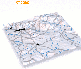 Places with similar names to Strada, Italy ::
// Start (RU)
// Staryye Atai (RU)
// Zaouia Taouert (MA)
// Zaouiat Ourti (MA)
// Sterrett (US)
// Strata (US)
// Stroud (US)
// Stuart (US)
// Strad (AT)
// Stuart (US)
Disclaimer :: Information on this page comes without warranty of any kind |
||
|
Where is Strada? Elevation and coordinates ::
Latitude (lat): 43°29'0"N Longitude (lon): 11°2'0"E
Elevation (approx.): 210m (map arrows pan, magnifying glasses zoom) |
||
|
Visiting Strada? Hotel/Accommodation ::
Book a hotel in Strada Travel Guide ::
Buy a travel guide for Italy rental cars ::
car rental offers GPS waypoint ::
download a GPX waypoint (PoI) of Strada for your GPS receiver
|
||