|
search place name
|
||
Trento (Trentino-Alto Adige, Italy)Trento is a town in the Trentino-Alto Adige region of Italy. An overview map of the region around Trento is displayed below.
regional and 3d topo map of Trento, Italy ::

Trento airports ::
The nearest airport is BZO - Bolzano, located 46.2 km north of Trento.
Other airports nearby include VIC - Vicenza (62.9 km south east), VRN - Villafranca (77.0 km south), QPA - Padova (93.0 km south east), VBS - Montichiari (94.5 km south west), Nearby towns ::
Cognola (1.3km east) //
Villazzano (1.3km east) //
San Rocco (2.3km south east) //
Vela (3.9km north) //
Sardagna (3.2km south west) //
Belvedere (3.2km south west) //
Civezzano (4.3km north east) //
Romagnano (6.1km south west) //
Lavis (7.5km north) //
Cadine (5.5km west) //
Mattarello (7.5km south) //
Albiano (9.0km north east) //
Casa Facciabella (9.0km north east) //
Vigolo Vattaro (9.0km south east) //
[all distances 'as the bird flies' and approximate] 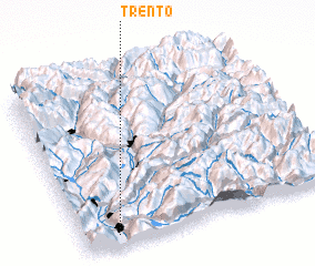 Places with similar names to Trento, Italy ::
Disclaimer :: Information on this page comes without warranty of any kind |
||
|
Where is Trento? Elevation and coordinates ::
Latitude (lat): 46°4'0"N Longitude (lon): 11°8'0"E
Elevation (approx.): 259m (map arrows pan, magnifying glasses zoom) |
||
|
Visiting Trento? Hotel/Accommodation ::
Book a hotel in Trento Travel Guide ::
Buy a travel guide for Italy rental cars ::
car rental offers GPS waypoint ::
download a GPX waypoint (PoI) of Trento for your GPS receiver
|
||