|
search place name
|
||
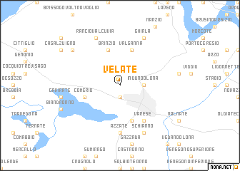
Velate (Italy)Velate is a town in Italy. An overview map of the region around Velate is displayed below.
regional and 3d topo map of Velate, Italy ::
Velate airports ::
The nearest airport is LUG - Lugano, located 19.2 km north east of Velate.
Other airports nearby include MXP - Milano Malpensa (25.0 km south), LIN - Milan Linate (58.4 km south east), BGY - Bergamo Orio Al Serio (73.0 km east), SMV - Samedan (113.1 km north east), Nearby towns ::
Masnago (1.9km south) //
Induno Olona (2.6km east) //
Brinzio (5.7km north) //
Ganna (5.7km north) //
Valganna (5.7km north) //
Comerio (4.3km south west) //
Capolago (5.7km south) //
Varese (6.1km south east) //
Azzate (7.4km south) //
Ghirla (7.8km north) //
Schianno (7.9km south) //
Rancio Valcuvia (7.8km north) //
Canonica (7.6km north west) //
[all distances 'as the bird flies' and approximate] 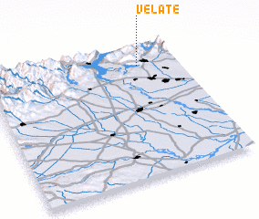 Places with similar names to Velate, Italy ::
Disclaimer :: Information on this page comes without warranty of any kind |
||
|
Where is Velate? Elevation and coordinates ::
Latitude (lat): 45°51'0"N Longitude (lon): 8°48'0"E
Elevation (approx.): 535m (map arrows pan, magnifying glasses zoom) |
||
|
Visiting Velate? Hotel/Accommodation ::
Book a hotel in Velate Travel Guide ::
Buy a travel guide for Italy rental cars ::
car rental offers GPS waypoint ::
download a GPX waypoint (PoI) of Velate for your GPS receiver
|
||