|
search place name
|
||
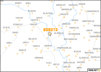
Babota (Nimba, Liberia)Babota is a town in the Nimba region of Liberia. An overview map of the region around Babota is displayed below.
regional and 3d topo map of Babota, Liberia ::
Babota airports ::
The nearest airport is MJC - Man, located 93.6 km north east of Babota.
Other airports nearby include DJO - Daloa (209.3 km east), Nearby towns ::
Gomahplay (1.6km south west) //
Blimiplay (3.2km east) //
Kokoko (4.6km south) //
Londasi (4.9km north east) //
Rondaze (5.1km north east) //
Blumtuo (5.4km south) //
Nyor Butuo (6.4km south west) //
Blontouo (6.7km south east) //
Doueleu (6.9km north east) //
Bolduye (6.9km west) //
Yample (7.0km south west) //
Nyor Diaplay (7.1km south west) //
Tiaplay (7.1km north west) //
Dolebio (7.1km west) //
Kouyaguiépleu (7.1km east) //
Konto (7.2km north west) //
Kpantouopleu (7.3km south east) //
Blipi Town (7.6km north) //
Banyouapleu (7.6km east) //
Leputa (7.8km north west) //
Yola (8.4km north) //
Nyoanplay (8.6km north east) //
Zotro Darra (8.6km east) //
Zaazota (8.8km north east) //
Kamepleu (9.0km east) //
Kpampleu (9.6km south east) //
Bayopleu (9.9km south east) //
Bloduwi (10.8km north west) //
Yaogotouo (11.3km south east) //
[all distances 'as the bird flies' and approximate] 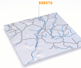 Places with similar names to Babota, Liberia ::
Disclaimer :: Information on this page comes without warranty of any kind |
||
|
Where is Babota? Elevation and coordinates ::
Latitude (lat): 6°55'50"N Longitude (lon): 8°21'44"W
Elevation (approx.): 246m (map arrows pan, magnifying glasses zoom) |
||
|
Visiting Babota? Hotel/Accommodation ::
Book a hotel in Babota Travel Guide ::
Buy a travel guide for Liberia rental cars ::
car rental offers GPS waypoint ::
download a GPX waypoint (PoI) of Babota for your GPS receiver
|
||